Hiking Around Las Vegas, Red Rock Canyon National Conservation Area
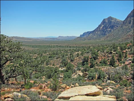
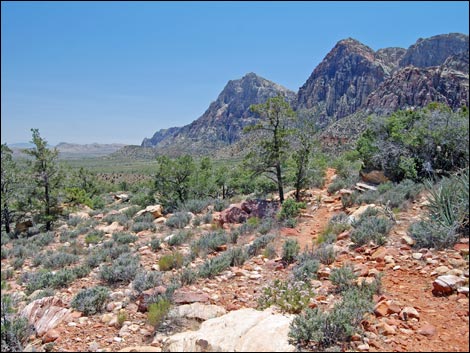
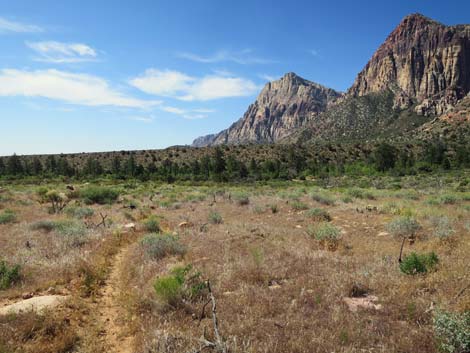
 Ice Box Canyon Trail approaching SMYC and Dales trails (view S) |
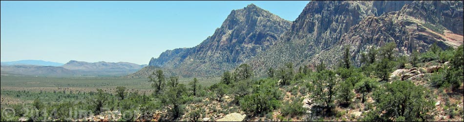
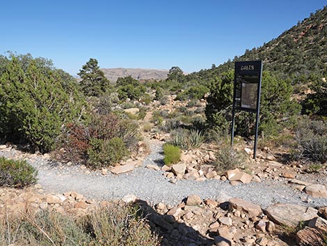
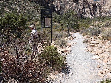
Overview Dales Trail is a 2.1-mile segment of the Escarpment Route that runs through open desert along the base of the Wilson Cliffs. Dales Trail runs between the Ice Box Canyon Trail and the Pine Creek Canyon Trail. The trail runs through Pinyon-Juniper Woodland vegetation at a fairly gentle grade most of the way, but it has several short, steep sections; it is quite rocky and hard to walk on; and it seems to twist and jog back and forth far more than is necessary. The south end of the trail cuts across a number of steep ravines, but rather than contour around the back of the ravine, the trail drops into each one and climbs back up the other side. In general, this trail was poorly laid out and is not among my favorites. Fortunately, park benches along the trail encourage you to stop, relax, and enjoy the splendid views. Link to map. Link to BLM Georeference PDF map file. |
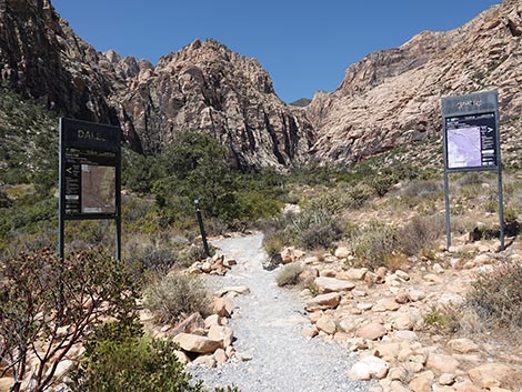
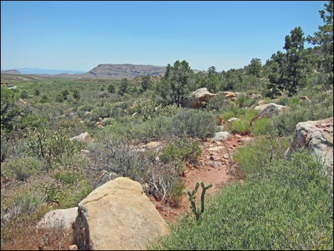
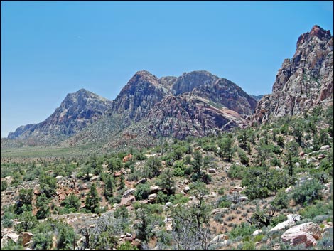
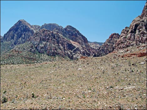
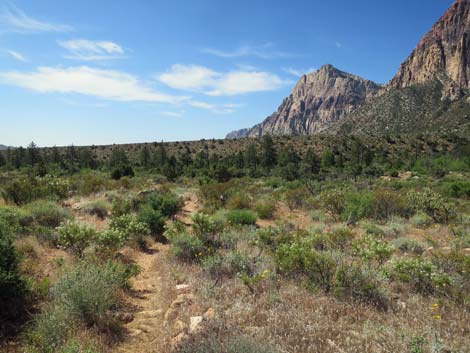
 Junction of Ice Box Canyon, SMYC, and Dales trails (view S) |
Dales Trail connects two trails, so it can be walked in either direction. Here, the trail is described as running from Ice Box Canyon to Pine Creek Canyon, which is the downhill direction. For hikers going the other direction, see Dales Trail Northbound. The total distance between the two trailheads is about 2.8 miles. Watch Out Other than the standard warnings about hiking in the desert, ...this is a moderately strenuous hike requiring careful attention to where you are stepping so as not to twist an ankle on the many loose rocks in the trail. While hiking, please respect the land and the other people out there, and try to Leave No Trace of your passage. Also, even though this is a short hike, be sure to bring what you need of the 10 Essentials. |
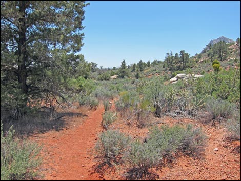
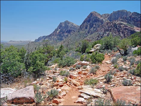
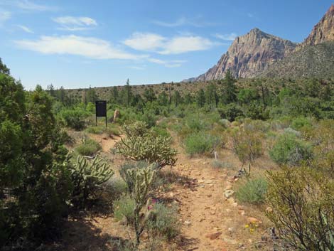
 Hiker turning from Ice Box Canyon onto Dales trail (view W) |
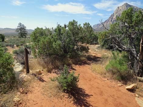
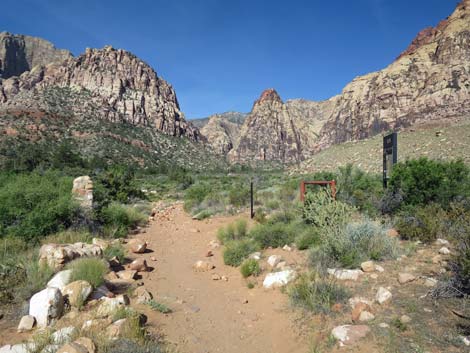
Getting to the Trailhead This hike is located along the Scenic Loop Road in Red Rock Canyon National Conservation Area, about 1 hour west of Las Vegas. Drive out to Red Rocks, pay the fee, and then drive about 2/3rds of the way around the Scenic Loop Road to the Ice Box Canyon Trailhead or the Pine Creek Canyon Trailhead. The Hike From the Ice Box Canyon Trailhead (Table 1, Waypoint 01), hikers must first walk southwest on the Ice Box Canyon Trail, cross Red Rock Wash, and continue towards Ice Box Canyon. After about 0.2 miles, the Ice Box Canyon Trail reaches a trail junction (Wpt. 02) where Dales Trail branches south (left), the Ice Box Canyon Trail continues west (straight) into the canyon, and the SMYC Trail turns north (right). |
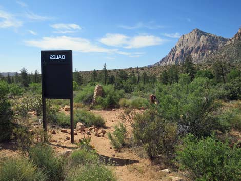
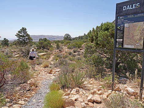 Hiker starting down Dales trail (view S) |
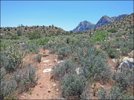
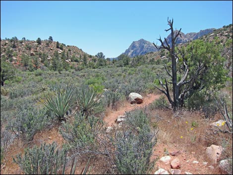
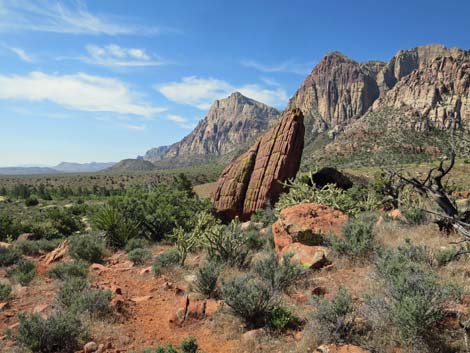
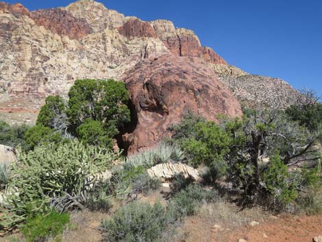
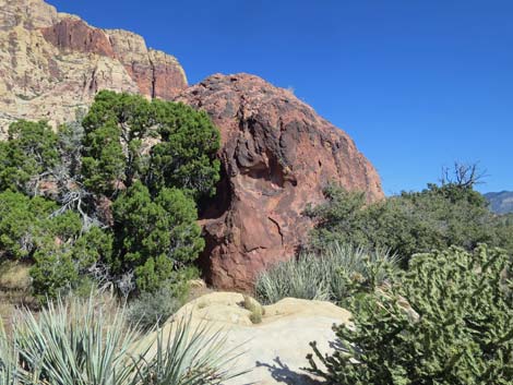
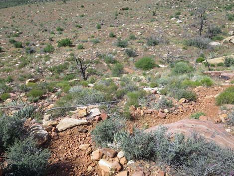
From the junction (Wpt. 02), Dales Trail runs south on rocky terrain and heads towards Ice Box Wash, which is only 2-3 minutes away. The trail drops into Ice Box Wash, goes upstream around a big shrub live oak tree, crosses the wash, and then climbs the bank on the far side. Just across the wash, a park bench in the sun beckons hikers to stop, relax, and gaze north towards the La Madre Mountains Wilderness Area. While here, notice that there is a lot of tall, dense vegetation in and near the edges of the wash (including shrub live oak, manzanita, singleleaf pinyon pine, sagebrush, and lots of other species). Heading south from here, hikers will quickly leave the wash-edge vegetation and get onto a sidehill environment dominated by blackbrush and buckhorn cholla, with singleleaf pinyon pine, Utah juniper, banana yucca, yerba santa, Mormon tea, Turpentinebroom, and bunchgrasses. On the sidehills, the vegetation is diverse, low-growing, and dense. The differences in vegetation relate to differences in the amount of soil moisture, soil types, and flashflood tolerance. |
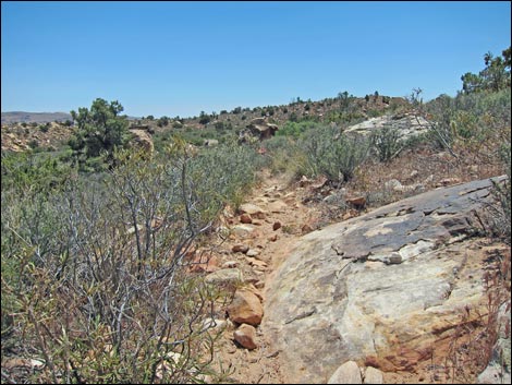
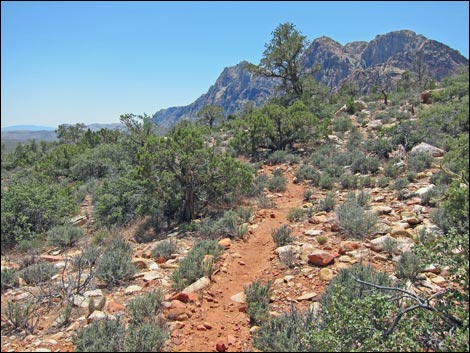
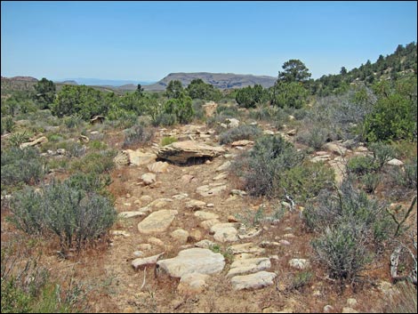 Parts of Dales Trail are rocky (view S) |
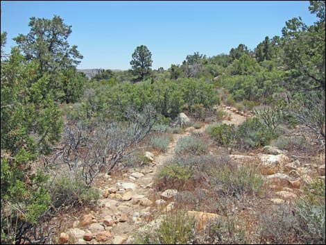
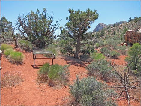
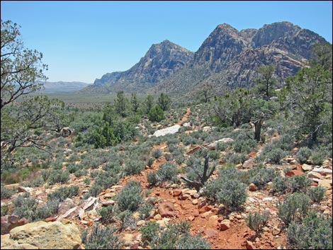
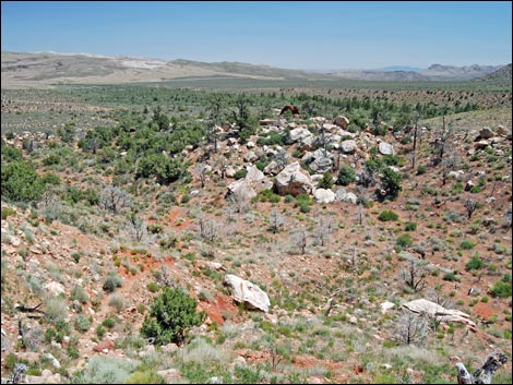
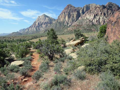
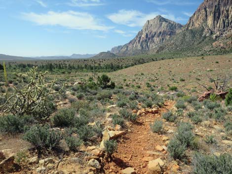
The rocky and winding trail runs out across a fairly flat area heading for little saddle that can be seen to the south. Here, the trail is a little easier to walk on, but it still is winding, rocky, and little used. Hikers do, however, start getting some nice view of the escarpment and the mountains (e.g., Mt. Wilson) to the south (Rainbow Mountain Wilderness Area). At about 0.8 miles out, hikers encounter another park bench (Wpt. 03) in a little pinyon-juniper woodland just north of the saddle. This bench also faces north, but it is in the shade of pinyon and juniper trees, with some nice big rocks and red soils, plus lots of mountain mahogany, buckhorn cholla, banana yucca, and blackbrush all around. |
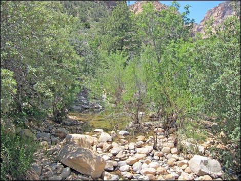 Crossing Ice Box Creek (view S) |
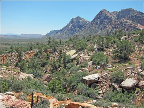
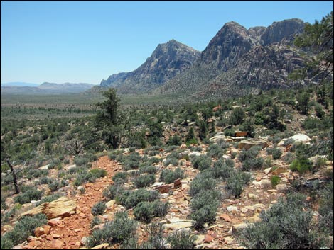
From the bench, the trail runs up over the saddle, then works across a hillside (Wpt. 04) with great views to the south down the valley, to the east towards Las Vegas, and to the north towards the La Madre Mountains. This is also about the first place where hikers can see the Pine Creek parking area, the destination for many on this part of the trail. From this viewpoint, the trail generally runs south as it cuts across a number of ravines. The trail runs steeply down into each ravine and steeply up the other side rather than contour around the hillside. One of the ridges is the highest point on the trail (Wpt. 05), which is reached at about 1.2 miles out. |
 |
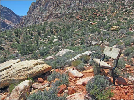
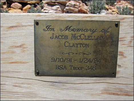
From the high point (Wpt. 05), the trail runs down the hillside for another 0.06 miles to another sunny bench (Wpt. 06) with a nice view overlooking Pine Creek and other points south. Above the bench is the imposing east face of Bridge Mountain. From the bench, the trail runs out for another 0.43 miles as it cuts steeply across more ravines until reaching the edge (about 1.65 miles out) of the major ravine (Wpt. 07) that forms the northern edge of Pine Creek canyon, although the creek still is pretty far off. |
 |
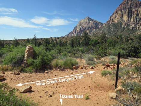
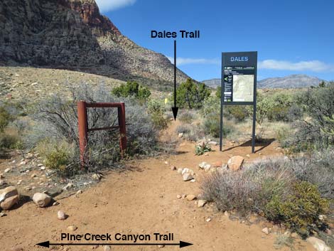
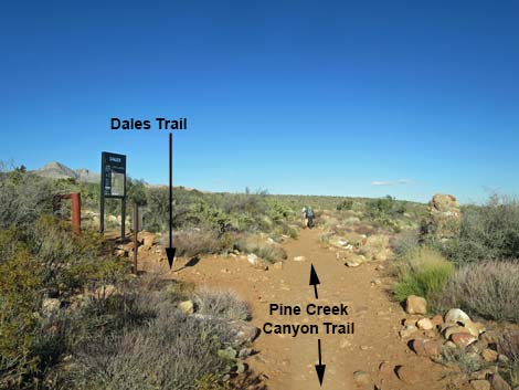
From there (Wpt. 07), the trail runs straight down the crest of the ridge to the toe, then switchbacks steeply down the toe of the ridge to the bottom of the canyon. The trail cuts steeply up the other side to the top of another ridge (Wpt. 08) that has nice views of Bridge Mountain and the trail on the toe of the ridge behind you. The trail continues downhill, generally at a gentle grade to a fourth park bench, this one adjacent to Skull Rock (Wpt. 09; 1.83 miles out). Beyond Skull Rock, the trail switchbacks down another short hillside, then cuts out across the rocky, sandy flats heading south to intersect the Pine Creek Trail (Wpt. 10; about 2.07 miles out). |
 |
The trail junction (Wpt. 10) marks the end of Dales Trail. From here, hikers can turn right and go west and up the Pine Creek Trail, turn left and hike east about 0.45 miles to the Pine Creek trailhead (Wpt. 11), or turn around and hike back to the Ice Box Canyon trailhead (Wpt. 01). The intersection is only about 0.3 miles from the remains of old-man Wilson's homeplace (Wpt. 12), so hikers might as well wander up and check it out before heading for home. |
 |
 |
 |
 |
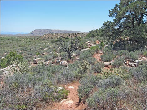
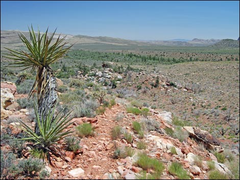
 Dales Trail heading towards a low saddle (view S) |
 Bench with a view to the north (view S) |
 |
 |
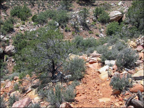
 Dales Trail at edge of canyon (view S) |
 Dales Trail drops steeply to cross the canyon (view S) |
 |
 |
 Another bench with a view (view SW) |
 Plaque on the bench with a view (view NW) |
 |
 |
 Dales Trail (view S) |
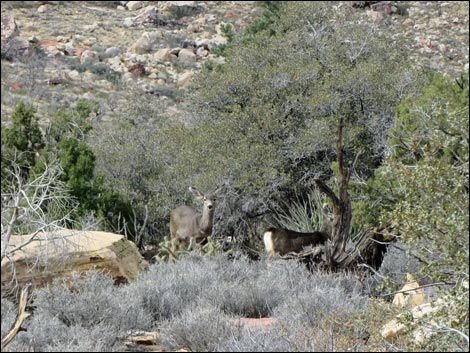 Mule Deer along Dales Trail (view W) |
 Dales Trail (view S) |
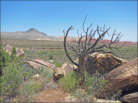
 Pine Creek Fire (2006, 2,300 acres; view SW) |
 Descending along ridgeline (Pine Creek Fire on right; view SE) |
 Descending towards white boulders (view SE) |
 Backside of Skull Rock (view S) |
 Passing around the side of Skull Rock (view S) |
 Skull Rock sign, on the left (view S) |
 Looking back: Skull Rock (view NW) |
 Looking back: Skull Rock (view NW) |
 Dales Trail descending along ridgeline past Skull Rock (view SE) |
 Dales Trail descends steeply off the side of the ridge (view S) |
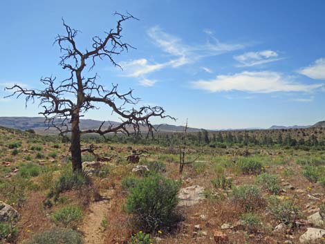 Stately victim of the Pine Creek Fire (view SE) |
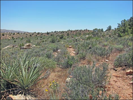
 Dales Trail traversing open desert flats (view S) |
 Dales Trail approaching Pine Creek Canyon Wash (view S) |
 Dales Trailhead sign comes into view (view S) |
 Backside of Dales Trailhead sign (view S) |
 Dales Trail at Pine Creek Canyon Trail (view S) |
 Pine Creek Canyon Trail approaching Dales Trail (view W) |
 Sign: Dales Trail (view N from Pine Creek Canyon Trail) |
 Pine Creek Canyon Trail approaching Dales Trail (view E) |
Table 1. Hiking Coordinates Based on GPS Data (NAD27; UTM Zone 11S). Download Hiking GPS Waypoints (*.gpx) file.
| Wpt. | Location | Easting | Northing | Elevation (ft) | Point-to-Point Distance (mi) | Cumulative Distance (mi) |
|---|---|---|---|---|---|---|
| 01 | Ice Box Canyon Trailhead | 636455 | 4001453 | 4,280 | . | . |
| 02 | Trail junction | 636233 | 4001218 | 4,307 | 0.00 | 0.00 |
| 03 | Park bench | 636800 | 4000352 | 4,268 | 0.78 | 0.78 |
| 04 | Hillside | 636830 | 4000056 | 4,314 | 0.21 | 0.99 |
| 05 | High point on the trail | 636756 | 3999907 | 4,341 | 0.16 | 1.15 |
| 06 | Sunny bench | 636743 | 3999828 | 4,336 | 0.05 | 1.20 |
| 07 | Edge of major ravine | 636678 | 3999243 | 4,205 | 0.43 | 1.63 |
| 08 | Top of ridge | 636829 | 3999119 | 4,103 | 0.14 | 1.77 |
| 09 | Skull Rock | 636869 | 3999058 | 4,076 | 0.06 | 1.83 |
| 10 | Pine Creek Trail | 636966 | 3998718 | 3,986 | 0.24 | 2.07 |
| 11 | Pine Creek trailhead | 637417 | 3999122 | 3,987 | . | . |
| 12 | Wilson's homeplace | 636507 | 3998522 | 4,030 | . | . |
Happy Hiking! All distances, elevations, and other facts are approximate.
![]() ; Last updated 250705
; Last updated 250705
| Hiking Around Red Rocks | Hiking Around Las Vegas | Glossary | Copyright, Conditions, Disclaimer | Home |