Backroads Around Las Vegas
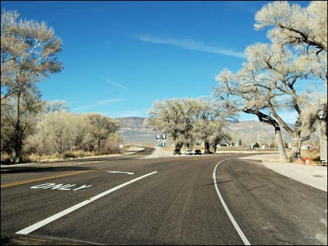
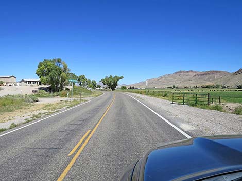
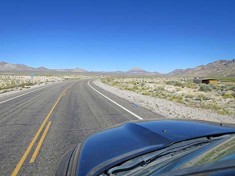
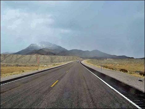
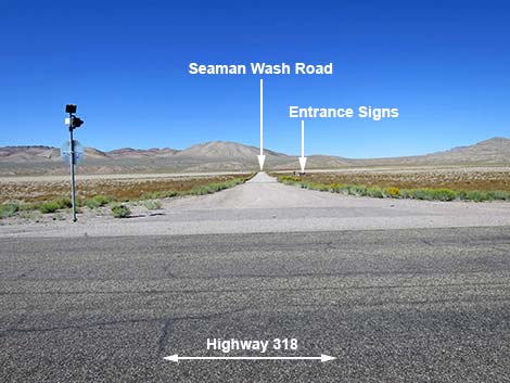
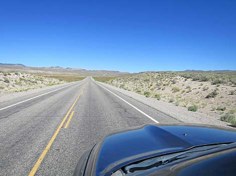
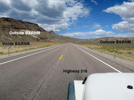
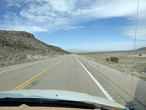
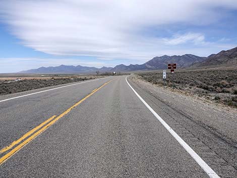
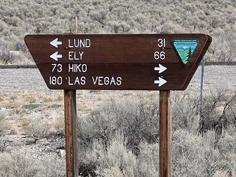
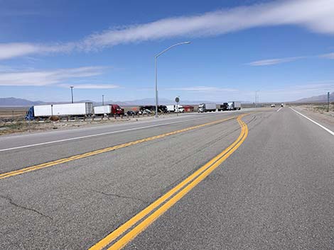
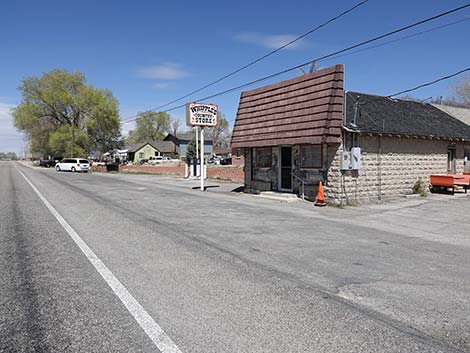
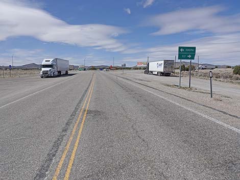
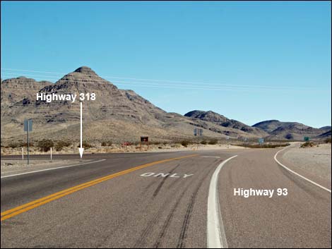 Highway 93 at Highway 318 (view NE) |
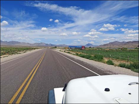
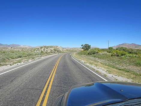
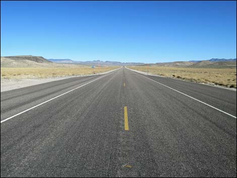
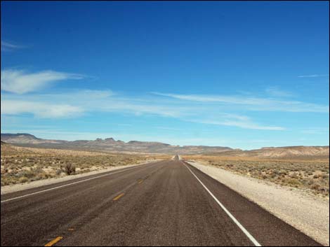
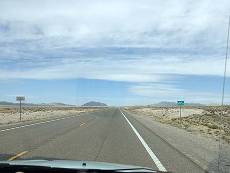
Overview Nevada Highway 318 isn't a "backroad," but it provides access to many of the places and backroads we love. Running 110 miles along the mostly dry White River, the highway passes through beautiful middle-Nevada Great Basin country, including broad open valleys and tight twisting narrows, all with mountain ranges along both sides. Highway 318 connects U.S. Highway 93 to the south with U.S. Highway 6 to the north. Highway 318 generally is straight with a speed limit of 70 mph. Gas, food, and supplies are available only at Lund, but Alamo (south of Hwy 318) and Elko (north of Hwy 318) are full-service towns. Highway 318 provides access to archeological sites (White River Narrows; Mt. Irish), Basin and Range National Monument, OHV trails, caves, and backroad adventures. Excellent birding opportunities can be found at Key-Pittman and Kirch state wildlife management areas. Drivers should always keep an eye out for Pronghorn; it is unlikely they will be on the road, but it is always fun to see them galloping across sagebrush flats. |
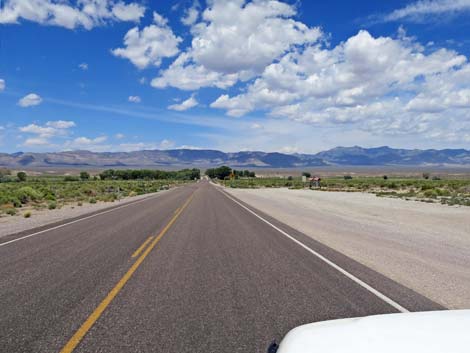
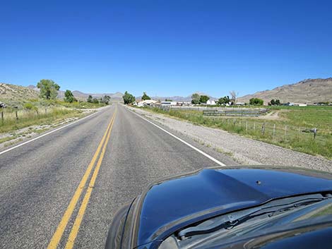
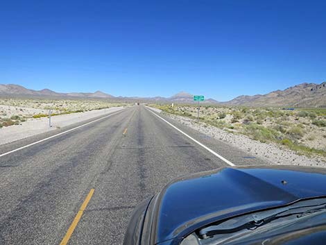
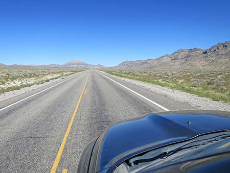
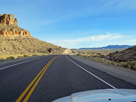
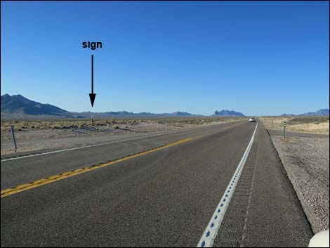
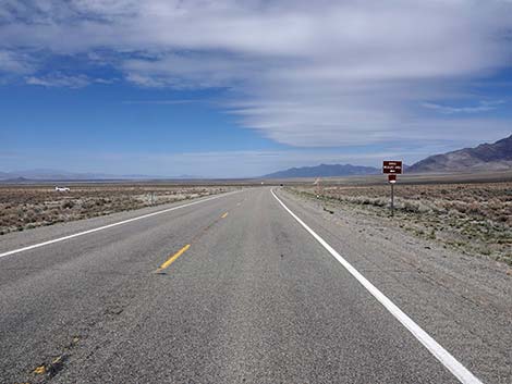
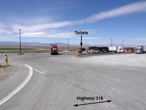
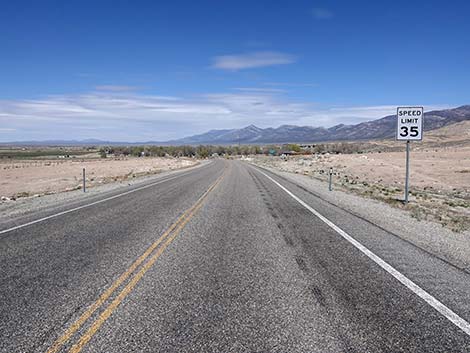
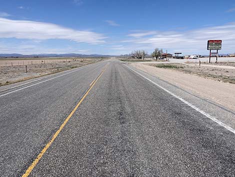
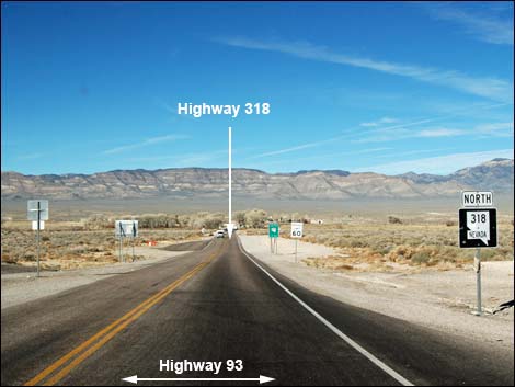 Start of Highway 318 (view NW) |
Link to Road Map. Watch Out Other than the standard warnings about being in the desert, ...this road is pretty safe, but be sure that your vehicle is in good working condition, carry plenty of water, and pack a few snacks. Always drive carefully; even though the road is maintained, there are occasional hazards such as errant rocks and holes in the roadway. While out, please respect the land and the other people out there, and try to Leave No Trace of your passage. This road goes into remote areas, so be sure to bring what you need of the 10 Essentials. Cell phones don't work in most areas. |
 |
Getting to the Road Highway 318 begins where it separates from Highway 93, just north of the towns of Ash Spring and Alamo. From Las Vegas, drive north on Interstate-15 for 21 miles to Exit 64. Watch for signs to Pioche, Ely, Alamo, Caliente, and Great Basin National Park. Exit right, then turn left at the stop sign onto Highway 93. Drive north 85 miles, passing Alamo (last full-service town) and Ash Springs (last gas and snacks) to Highway 318 on the left. Consider picking up some Alien Jerky at the intersection for snacks during the drive north. |
 Approaching entrance to Key-Pittman WMA, Frenchy Lake (view NW) |
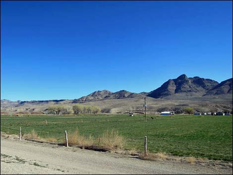
The Road Beginning high on the east side of Pahranagat Valley, Highway 318 (Table 1, Site 0677) runs northwest and downhill towards the White River, which for the most part stopped flowing above ground at the end of the last ice age. It pops out, however, in several places, including to the right where it fills Frenchy Lake (part of Key-Pittman Wildlife Management Area) and ahead in the cottonwood trees on the left where it pops out as Crystal Spring and flows for a short distance downstream. At about 0.3 miles out, just before crossing a cattle guard, Frenchy Lake access road turns off to the right. Watch for information signs and a broad gravel parking area. This side road provides access to a parking area with a vault toilet, and from there a trail leads to the east side of Frenchy Lake. During summer the lake often is dry, but during winter it provides wetland habitat for wintering ducks, geese, and swans. |
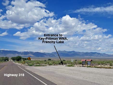 Entrance to Key-Pittman WMA, Frenchy Lake (view NW) |
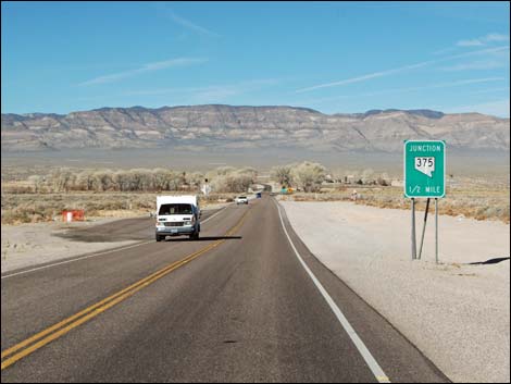
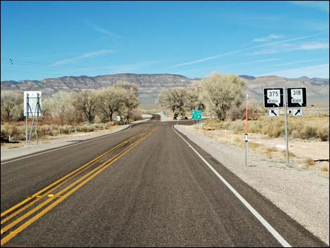
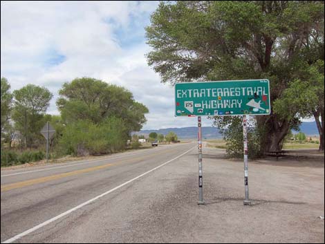
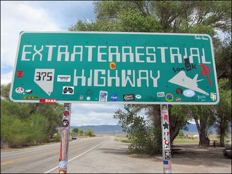
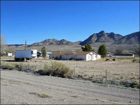
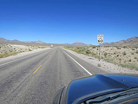
At about 0.7 miles out, under the cottonwood trees, Highway 375 (Site 0676) forks left (straight) as Highway 318 bends to the right. Before passing the intersection, birders might want to stop and check the trees and along the water for birds. This is also an informal roadside rest area with picnic tables under the trees, but no toilets. Be sure to pose for a photo in front of the Extraterrestrial Highway sign -- as thousands of people do every year. Continuing, the highway bends north and Frenchy Lake (on the right) fades into the distance. Before long, the highway, which was signed at 60 mph, drops to 45 mph as it approaches the town of Hiko. Mind the signs, as the county sheriff and state highway patrol take a lot of money from people speeding through Hiko. The first evidence of Hiko is a cattle feed lot about 2 miles out, and shortly the road passes houses, pastures, and farm fields. Keep an eye on the hillside to the left where stone foundations of historic buildings can be seen above the road. |
 |
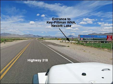
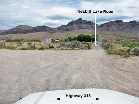
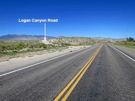
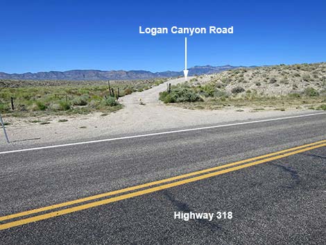
At 2.9 miles out, information signs in a broad gravel parking lot on the right announce the Nesbitt Lake Unit (Site 0678) of Key-Pittman Wildlife Management Area. The gate into Nesbitt Lake is always closed, but not locked, and visitors are welcome to drive the short distance to a vault toilet and to the shady cottonwood trees beyond. Nesbitt Lake, fed by the White River, is permanent water and provides habitat for waterfowl and other waterbirds all year. Turkey Vultures like to roost in the tall trees. Shortly beyond the Nesbitt Lake parking area, at 3.1 miles out, a dirt road to the left runs up a low hillside. The road is blocked by a wire-fence gate. This is Logan Canyon Road (Site 1130), which leads into Basin and Range National Monument and provides access to the Mount Irish Archeological District, the Mount Irish Wilderness Area, the historic ghost town of Logan, and other backcountry adventures. Be sure to close the gate properly. |
 Approaching intersection of 375 (left; straight) and 318 (right) |
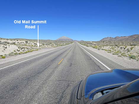
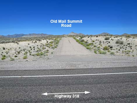
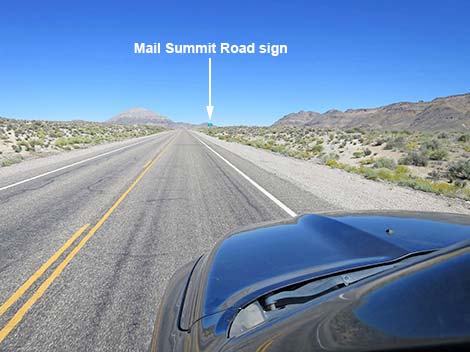
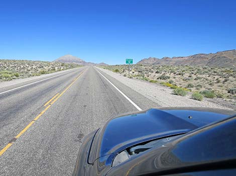
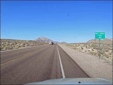
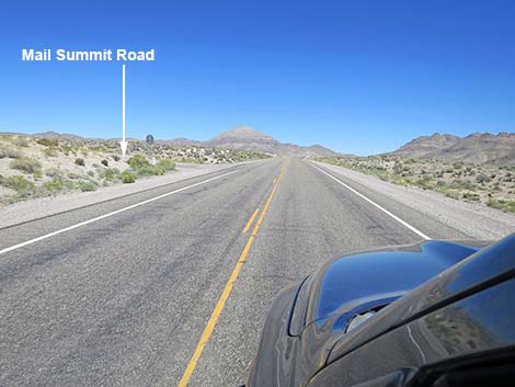
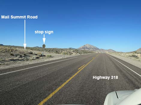
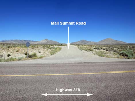
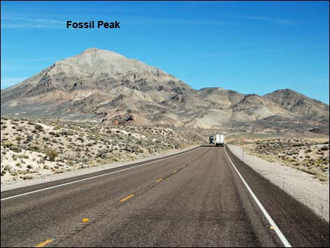
Continuing north, about 6 miles out, Highway 318 passes out of Hiko. At 9.4 miles out, the highway passes Mail Summit Road (Site 0886) on the left. There are no signs, but watch for a stop sign and a paved apron leading from the highway to a cattle guard. Mail Summit Road runs northwest into Basin and Range National Monument, passing over the mountains at a gap between the Mount Irish Range to the south and Seaman Range to the north and dropping into the south end of Coal Valley. This road provides access to Leviathan Cave, and it can be used to access Michael Heizer's land art sculpture City, but it is not the easiest access. At about 12.9 miles out, as Highway 318 leaves the Pahranagat Valley, it begins to form the boundary of Basin and Range National Monument. The land to the left is inside the National Monument. Continuing north, Highway 318 passes Fossil Peak on the left (said to contain quite a collection of Paleozoic fossils such as crinoids, brachiopods, and corals), then runs through a gap in the mountains carved by the White River (13.5 miles out) and enters White River Valley. |
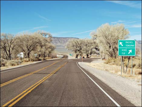
 Highway 318 at Highway 375 (view NW) |
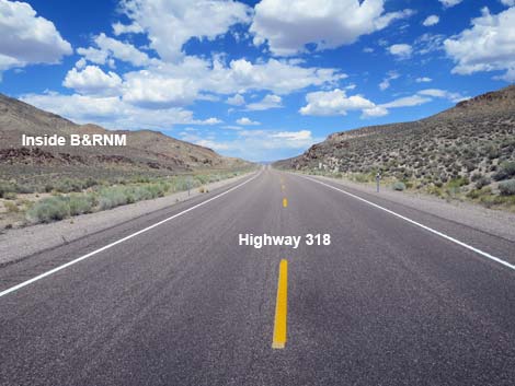
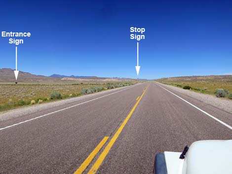
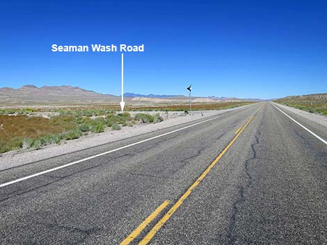
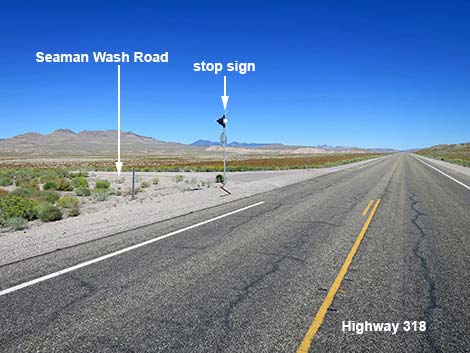
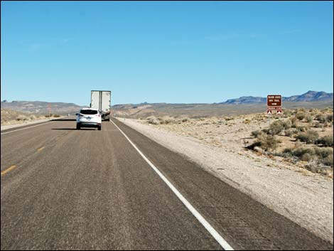
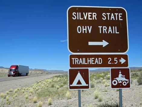
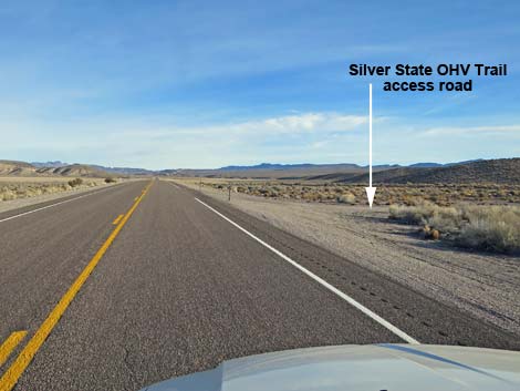
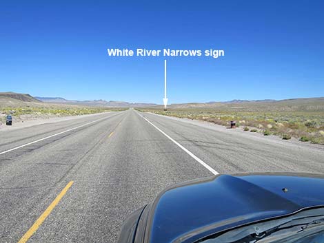
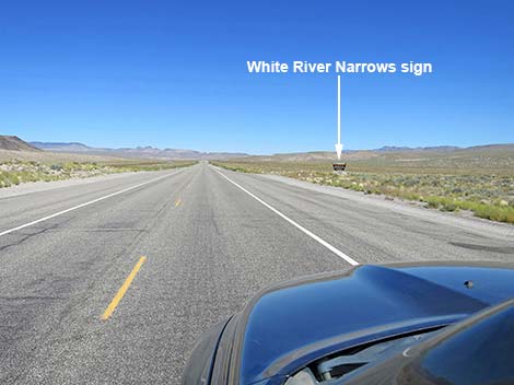
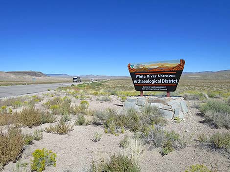
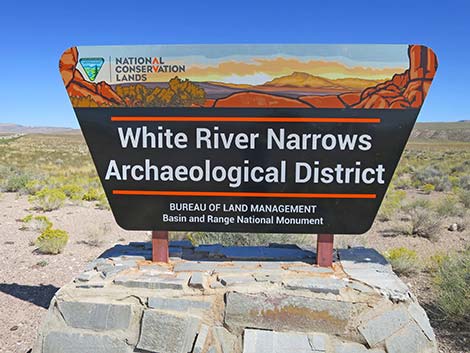
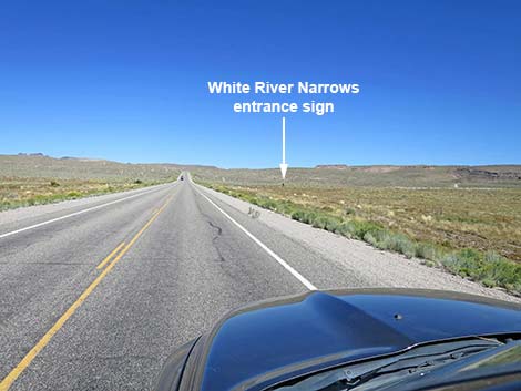
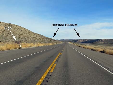
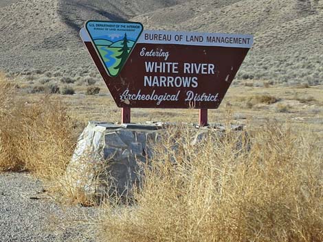
Running northeast through the broad White River Valley, at 17.4 miles out, Highway 318 passes Seaman Wash Road (Site 1548), on the left. There are no signs, but watch for a stop sign and a solar-powered flashing red light that faces away from the highway. Seaman Wash Road runs northwest into the Seaman Range, passing twisting narrows and a high saddle before gliding gently into Coal Valley and the heart of Basin and Range National Monument. Seaman Wash Road provides the easiest access to Michael Heizer's land art sculpture City. At 17.9 miles out, Highway 318 passes a road, on the right, that provides access to the Silver State OHV Trail, a system of dirt roads some 300 miles in total. At 19.8 miles out, a wide spot in the road serves as a roadside rest area with trash cans but no restrooms. At the north end of the parking area, a large signs announce the White River Narrows Archeological District and provide some information about the area, but there are no archeological artifacts in the immediate area of the sign. Near here, the highway enters Basin and Range National Monument. |
 Highway 375: Extraterrestrial Highway (view NW) |
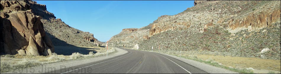
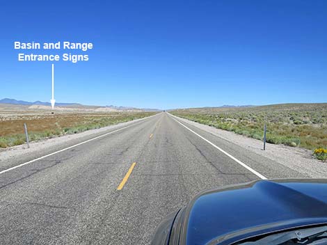
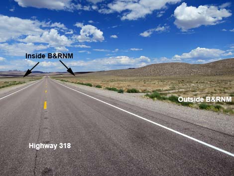
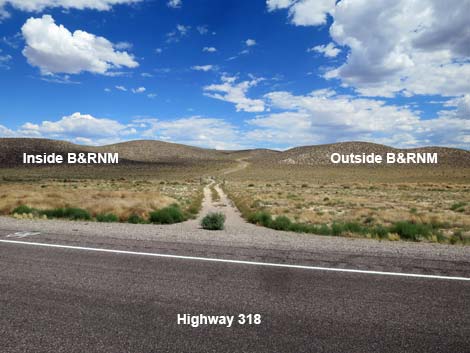
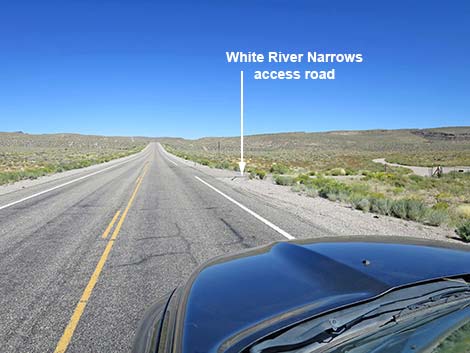
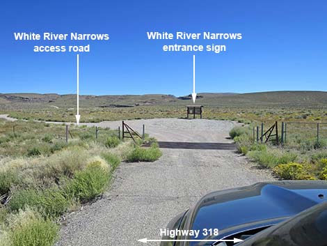
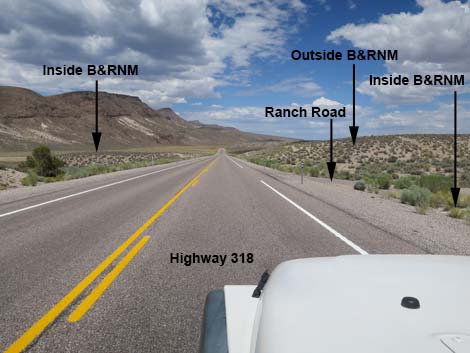
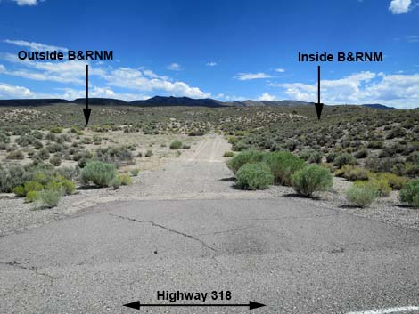
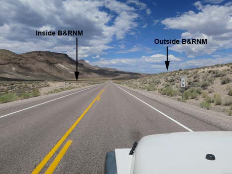
At about 21.4 miles out, the boundary of Basin and Range National Monument, which has been running parallel to the highway on the left, crosses the highway to follow a dirt road right. For the next 7 miles, visitors are inside the national monument. At 23.8 miles out, White River Narrows Road (Site 1105) turns off to the right. There are no signs, but watch for a cattle guard and gate in the highway fence. White River Narrows Road is the trace of the original highway, but running through the narrows, the highway frequently washed out and was rerouted to the current location. White River Narrows Road provides access to "Valley of Faces" (staying right on the main road, and the best of the White River Narrows rock art site (staying left up the berm). Continuing north, Highway 318 runs up into the White River Narrows, proper (about 25.4 miles out). Here, the White River cut a sinuous path through towering cliffs (solidified volcanic ash called rhyolite). In several places along the narrows, native peoples left petroglyphs on the cliff faces. |
 Highway 375: Extraterrestrial Highway (view NW) |
Emerging from the narrows, about 27.5 miles out, the road runs north, more-or-less following the edge of White River Valley. In this area, the mountains to the right are the North Pahroc Range, while those to the left are still the Seaman Range. At 28.0 miles out, a dirt road comes in from the right. This side road marks the northern boundary of Basin and Range National Monument on the right side of the road. From here northward to 33.0 miles out, only the left side of the road is inside the national monument. Beyond mile 33, the boundary pulls back from the edge of the road and follows the base of the peaks to the west. The northern-most tip of the national monument is due west of mile 64 along the highway, but that point is pretty far west. At about 45 miles out, the highway bends right and begins to climb out of the White River Valley. In this area, at the north end of the Seaman Range, the high peak to the left is Timber Mountain which is said to have Ponderosa Pines growing on the top. |
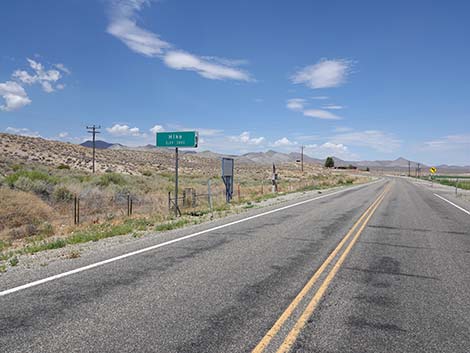
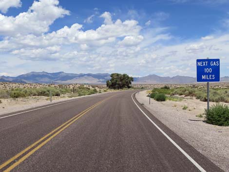 Warning: next gas 100 miles to Lund (view NW) |
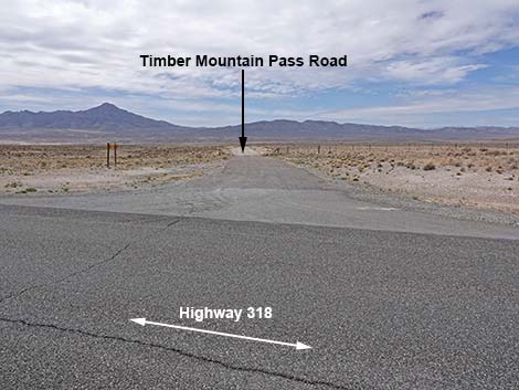
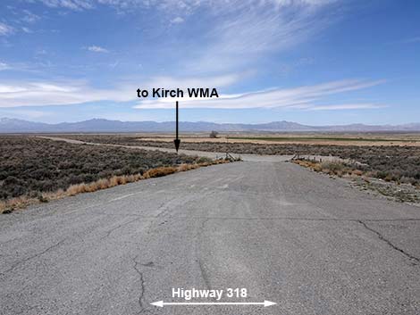
At 49.1 miles out, Highway 318 passes Timber Mountain Pass Road (Site 1546), on the left. There are no signs along the highway, but watch for a directional sign a few yards from the highway down Timber Mountain Pass Road. This road provides access to Timber Mountain, northern portions of Coal Valley, and for people arriving from the north, this is the best road to visit Michael Heizer's City. Continuing north, Highway 318 descends desert slopes, passes tight against the base of Gap Mountain on the left (60.5 miles out), and returns to the edge of White River Valley. At 61.8 miles out (Site 1604), the unmarked Coal Valley North Road left (watch for a stop sign) provides access to southern portions of Wayne E. Kirch Wildlife Management Area and northern Coal Valley. |
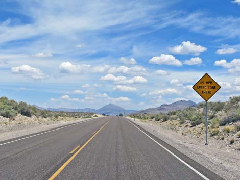 Warning: 45 mph zone ahead (view N) |
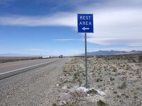
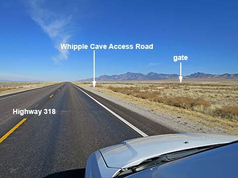
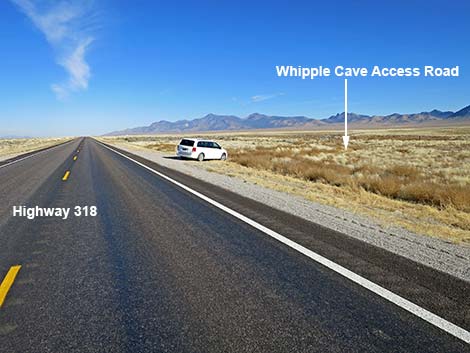
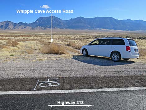
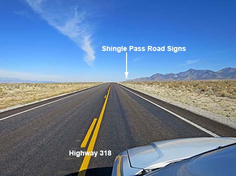
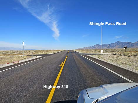
At 67.5 miles out (Site 1605), the unmarked Garden Valley North Road to the left (watch for a stop sign) provides access to Sunnyside, northern portions of Kirch Wildlife Management Area, and northern Garden Valley. Continuing north, the road runs northeast, then bends a bit left to run more due north, and passes a roadside rest area, with toilets, at about 70.2 miles out. Continuing straight, at about 72.9 miles out (Site 0930), the highway passes an obscure, unmarked dirt road to the right. Watch for a wire-fence gate in the highway fence. This side road provides access to Whipple Cave in the Far South Egans Range to the east. The next road, Shingle Pass Road at 75.1 miles out, also provides access to Whipple Cave, but be sure to bring aerial photo maps. |
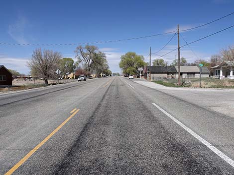
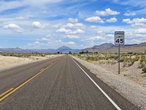 45 mph through Hiko -- NHP stays busy here (view N) |
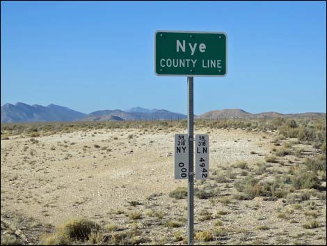
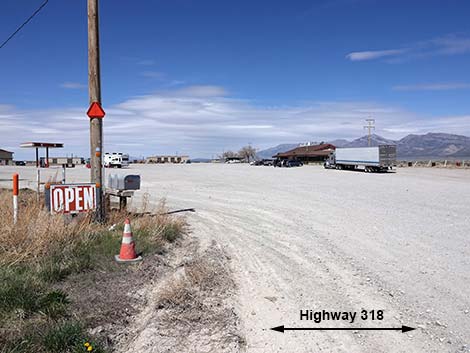
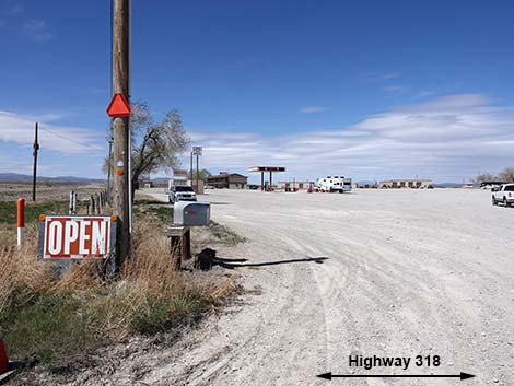
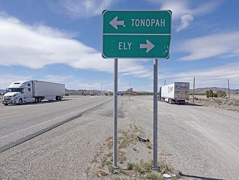
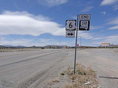
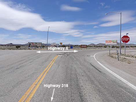
Continuing, Highway 318 runs north, passes the Nye-White Pine County line (88.3 miles out), and eventually arrives in Lund, a full-service town. Lund has the small Whipple Family Country Store (Site 0935; 99.1 miles out), which provides fuel, snacks, and a grill, and Lane's Coffee Shop and Travel Store (103.4 miles out) that also provides food and fuel, and perhaps the only lodging in town. Folks in the Whipple Family Country Store have always been nice to me. Beyond Lund, Highway 318 continues northwest to end at the intersection with U.S. Highway 6 (Site 1606; 110.8 miles out). From there, travelers can continue northeast to Ely (about 24 miles) or turn southwest towards Tonopah (about 144 miles). |
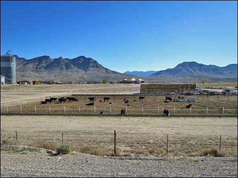 Hiko town: feedlot (view E) |
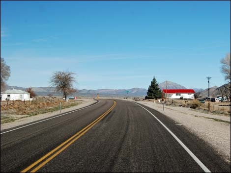 Hiko town: residences long the highway (view N) |
 Hiko town: residences (view NE) |
 Hiko town: alfalfa field (view NE) |
 Hiko town: approaching Key-Pittman WMA, Nesbitt Lake (view N) |
 Hiko town: Entrance to Key-Pittman WMA, Nesbitt Lake (view N) |
 Nesbitt Lake entrance (view E from Hwy 318) |
 Nesbitt Lake information signs (view E from Hwy 318) |
 Hiko town: approaching Logan Canyon Road turnoff (view N) |
 Highway 318 at Logan Canyon Road turnoff (view N) |
 Logan Canyon Road turnoff (view NW from Hwy 318) |
 Highway 318 continuing through Hiko (view N) |
 Highway 318 continuing through Hiko (view N) |
 Highway 318 approaching Hiko Dump Road (view N) |
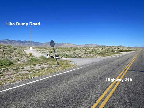 Highway 318 at Hiko Dump Road (view N) |
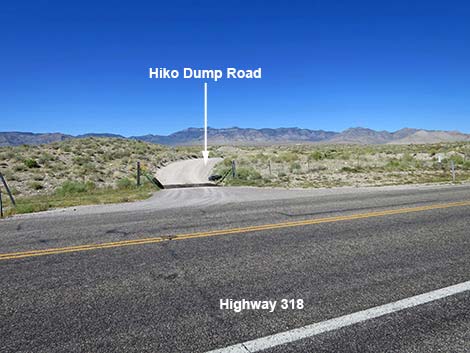 Hiko Dump Road (view W from Highway 318) |
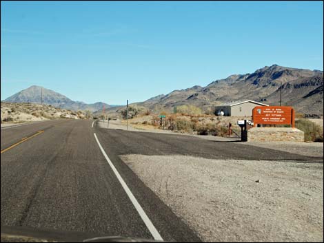 Hiko town: approaching Key-Pittman WMA headquarters (view N) |
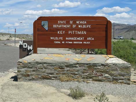 Key-Pittman WMA headquarters sign (view N) |
 Hiko town: homes and cattle pasture (view N) |
 Hiko town: homes and cattle pasture (view N) |
 Hiko town: roadside residences (view N) |
 Approaching Hiko town sign (view N) |
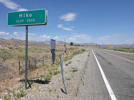 Hiko town sign (view N) |
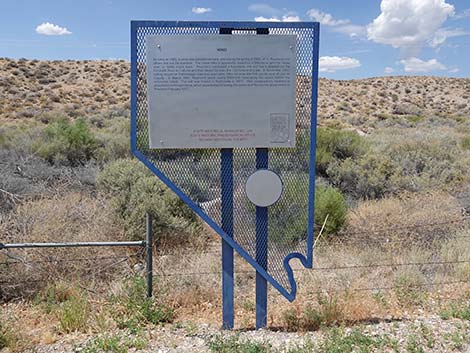 Historic marker sign at Hiko town sign (view W) |
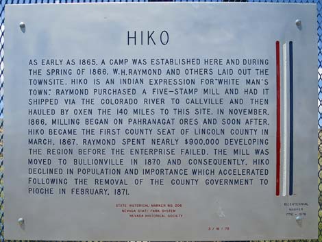 Text of Historic marker sign (view W) |
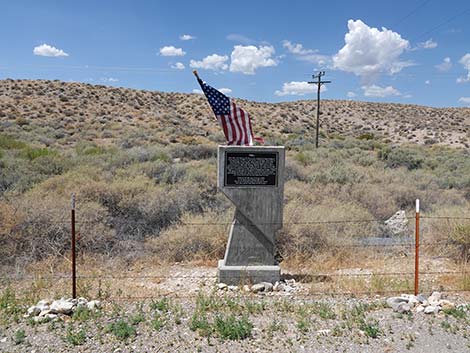 Monument at Hiko town sign (view W) |
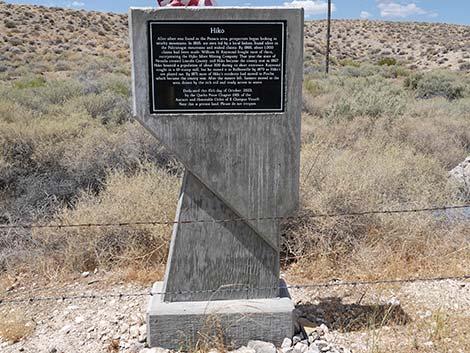 Hiko monument (view W) |
 Text of Hiko monument (view W) |
 Departing Hiko, road curves left to climb hill (view N) |
 Highway 318 climbing hill to leave Hiko (view NW) |
 Highway 318 climbs onto desert flats (view N) |
 Leaving Hiko (view N) |
 Speed limit bumps from 45 to 60 mph (view N) |
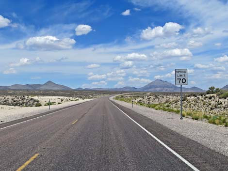 Speed limit soon bumps from 60 to 70 mph (view N) |
 Highway 318 heading into the Great Basin Desert (view N) |
 Highway 318 at Old (closed) Mail Summit Road (view N) |
 Old (closed) Mail Summit Road (view NW from Highway 318) |
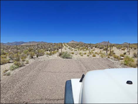 Old Mail Summit Road really is closed (view NW) |
 Approaching Mail Summit Road (view N) |
 Approaching Mail Summit Road (view N) |
 Mail Summit Road sign (view N) |
 Hwy 318 at Mail Summit Road (view N; note crest of hill ahead) |
 Approaching Mail Summit Road (watch for stop sign; view N) |
 Mail Summit Road (view W from Highway 318) |
 Highway 318 continuing past Mail Summit Road (view N) |
 Hwy 318 approaching Fossil Peak during summer (view N) |
 Hwy 318 approaching Fossil Peak during snowstorm (view N) |
 Hwy 318 approaching Fossil Peak in Basin & Range NM (view N) |
 Hwy 318 meets boundary of B&RNM (view NE) |
 Grand open scenery: iconic Nevada landscape (view N) |
 Basin and Range entrance sign in the distance (view N) |
 Highway 318 approaching Seaman Wash Road (view NE) |
 Highway 318 approaching Seaman Wash Road (view N) |
 Highway 318 at Seaman Wash Road (view N) |
 Seaman Wash Road (view W from Highway 318) |
 Approaching Silver State OHV Trail access road (view NE) |
 Sign: Silver State OHV Trail to the right (view NE) |
 Hwy 318 at Silver State OHV Trail access road (view NE) |
 Boundary of B&RNM crosses Highway 318 |
 This road marks the boundary of B&RNM (view E from Highway 318) |
 Approaching White River Narrows Archeological District (view NE) |
 Approaching White River Narrows Archeological District sign |
 White River Narrows Archeological District sign (view N) |
 White River Narrows Archeological District sign (view N) |
 Hwy 318 continuing past White River Narrows sign (view NE) |
 Hwy 318 (view NE) |
 Hwy 318 (view NE) |
 Hwy 318 approaching White River Narrows Road (view NE) |
 Hwy 318 approaching White River Narrows Road (view NE) |
 White River Narrows Road (view SE from Hwy 318) |
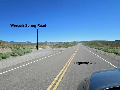 Highway 318 approaching Weepah Spring Road (view N) |
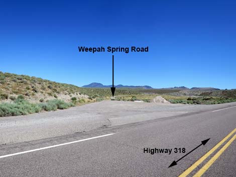 Weepah Spring Road (view NW from Highway 318) |
 Hwy 318 entering White River Narrows (view NE) |
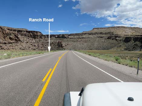 Hwy 318 approaching Ranch Road (view NE) |
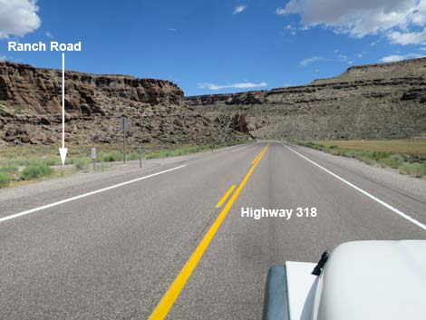 Hwy 318 approaching Ranch Road (view NE) |
 This Ranch Road marks the boundary of B&RNM (view NE) |
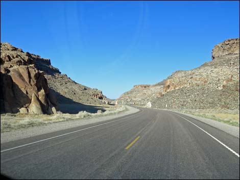 White River Narrows (view NE) |
 White River Narrows (view NE) |
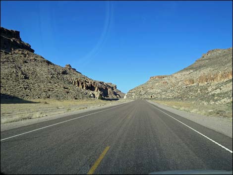
 Exiting the White River Narrows (view NE) |
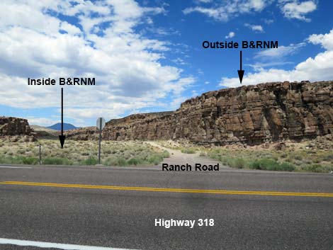
 Highway 318 approaching a Ranch Road (view N) |
 This Ranch Road marks the boundary of B&RNM (view NE) |
 West side of the highway in inside the National Monument (view N) |
 Flats on west side of the highway in inside the Monument (view N) |
 North end of the White River Narrows Archeological District |
 Looking back at the White River Narrows Archeological District sign |
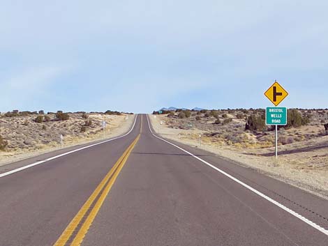 Approaching Bristol Wells Road (view N) |
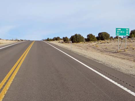 Highway mileage sign: Lund 52; Hwy-6 64; Ely 86 (view N) |
 Approaching Timber Mountain Pass Road (view N) |
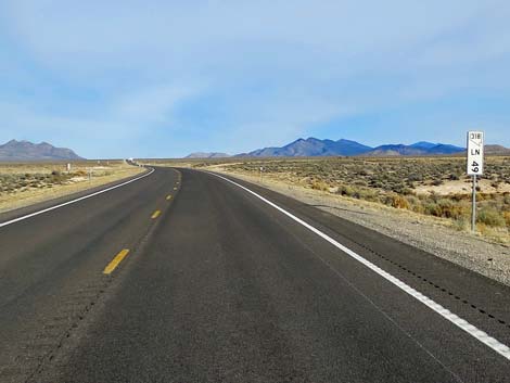 Mile Marker LN-49 approaching Timber Mtn Pass Road (view N) |
 Approaching Timber Mountain Pass Road (view N) |
 Hwy 318 at Timber Mountain Pass Road (view N) |
 Timber Mountain Pass Road (view SW from Hwy 318) |
 Hwy 318 at Lincoln-Nye County line (view N) |
 Lincoln-Nye County line (view NE) |
 Highway 318 at Gap Mountain, on the left (view NW) |
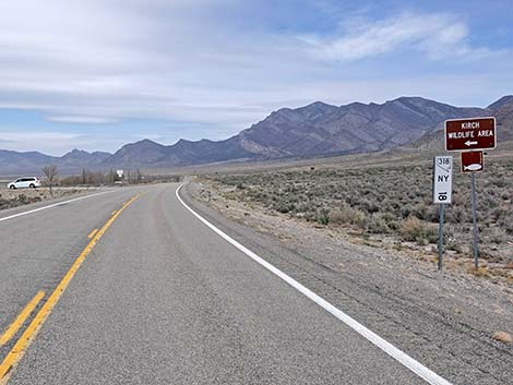
 Approaching Kirch Wildlife Area, south access road (view N) |
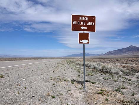 Kirch Wildlife Management Area, south access road sign (view N) |
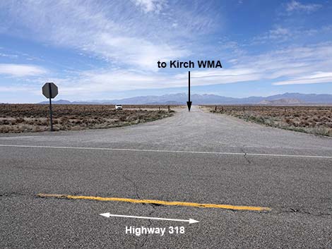 Kirch Wildlife Area, south access road (view W from Hwy 318) |
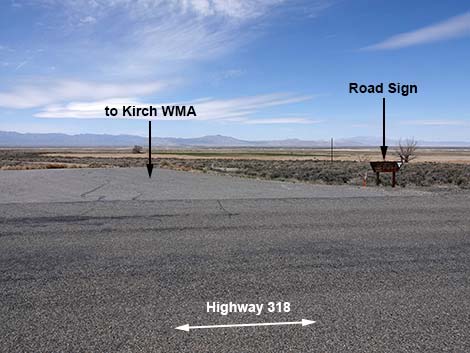
 Approaching Kirch Wildlife Area north access road (view N) |
 Kirch Wildlife Area north access road sign (mile post 18; view N) |
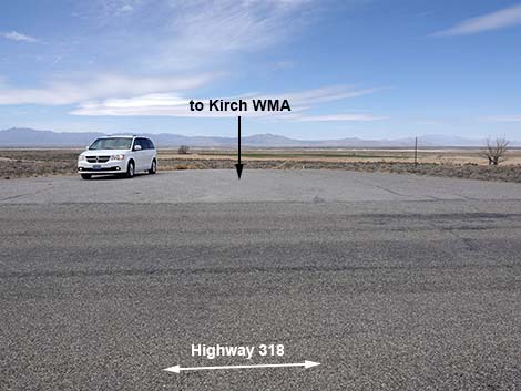 Kirch Wildlife Area north access road (view W from Hwy 318) |
 Kirch Wildlife Area north access road (view W from Hwy 318) |
 Backside: Kirch Wildlife Area north access road sign (view E) |
 Start of Kirch Wildlife Area north access road (view W) |
 Approaching Sunnyside Rest Area sign (view N) |
 Sunnyside Rest Area sign (view N) |
 Approaching Sunnyside Rest Area; with toilets (view N) |
 Sunnyside Rest Area; with toilets (view NW from Highway 318) |
 Approaching Whipple Cave access Road (view N) |
 Hwy 318 at Whipple Cave access Road (view N) |
 Whipple Cave access Road (view NW from Hwy 318) |
 Highway distances sign (view N) |
 Highway 318 approaching Shingle Pass Road (view N) |
 Highway 318 at Shingle Pass Road (view N) |
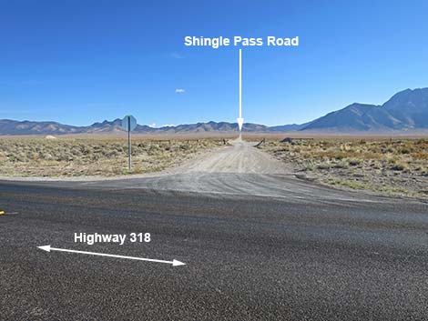 Shingle Pass Road (view E from Highway 318) |
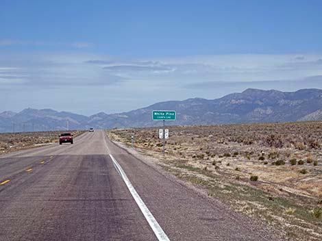 Approaching Nye-White Pine County line (view N) |
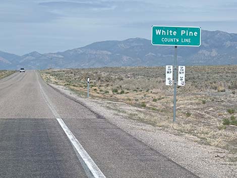 White Pine County line (view N) |
 Approaching Lund; note reduced speed (view N) |
 Reduce speed approaching Lund (view N) |
 Downtown Lund (view N) |
 Lund (Whipple Family Country Store, first gas since Ash Springs) |
 Whipple Family Country Store (view N) |
 Whipple Family Country Store (view NE) |
 Whipple Family Country Store gas pumps [might be closed] (view E) |
 North Lund; approaching Lane's Travel Center (view N) |
 Lane's Travel Center (view NE from Hwy 318) |
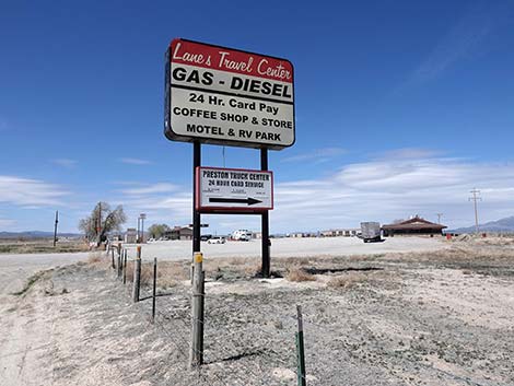 Lane's Travel Center sign (view N) |
 Entering Lane's Travel Center (view NE to restaurant) |
 Entering Lane's Travel Center (view N to motel and gas) |
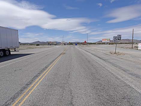
 Highway 318 approaching Highway 6 (view N) |
 Sign: Highway 318 approaching Highway 6 (view N) |
 Highway 318 approaching Highway 6 (view N) |
 Sign: Highway 318 approaching Highway 6 (view N) |
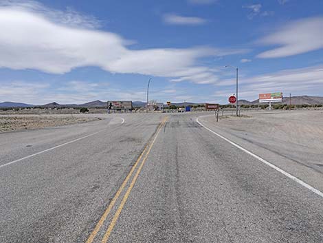 Highway 318 approaching Highway 6 (view N) |
 Highway 318 ends at Highway 6 (view N) |
 More to come ... |
Table 1. Highway Coordinates based on GPS Data (NAD27). Download highway GPS waypoints (gpx) file.
| Wpt. | Location | UTM Easting | UTM Northing | Elevation (ft) | Point-to-Point Distance (mi) | Cumulative Distance (mi) | Verified |
|---|---|---|---|---|---|---|---|
| 0677 | Hwy 93 at Hwy 318 | 37.52891 | 115.21911 | 3,831 | 00.0 | 000.00 | Yes |
| 0676 | Hwy 318 at Hwy 375 | 37.53219 | 115.23044 | 3,800 | 00.7 | 000.70 | Yes |
| 0678 | Hwy 318 at Nesbitt Lake gate | 37.56301 | 115.22912 | 3,846 | 02.2 | 002.90 | Yes |
| 1130 | Hwy 318 at Logan Cyn Rd | 37.56657 | 115.23051 | 3,844 | 00.3 | 003.20 | Yes |
| 0886 | Hwy 318 at Mail Summit Rd | 37.65247 | 115.20742 | 4,125 | 06.2 | 009.40 | Yes |
| 1548 | Hwy 318 at Seaman Wash Rd | 37.74011 | 115.11826 | 4,236 | 08.0 | 017.40 | Yes |
| 1105 | Hwy 318 at Wt River Narrows Rd | 37.81998 | 115.05729 | 4,471 | 06.4 | 023.80 | Yes |
| 1546 | Hwy 318 at Timber Pass Rd | 38.15467 | 114.99927 | 5,385 | 25.4 | 049.20 | Yes |
| 1604 | Hwy 318 at Coal Valley North Rd | 38.33426 | 115.04333 | 5,442 | 12.6 | 061.80 | Yes |
| 1605 | Hwy 318 at Garden Valley N Rd | 38.41493 | 115.02651 | 5,311 | 05.7 | 067.50 | Yes |
| 0930 | Hwy 318 at Whipple Cave Rd | 38.48906 | 115.01825 | 5,325 | 05.4 | 072.90 | Yes |
| 0935 | Hwy 318 at Lund | 38.85667 | 115.00694 | 5,560 | 26.1 | 099.00 | Yes |
| 1606 | Hwy 318 at Hwy 6 | 38.99750 | 115.12325 | 5,955 | 11.8 | 110.80 | Yes |
Happy Hiking! All distances, elevations, and other facts are approximate.
![]() ; Last updated 241115
; Last updated 241115
| Backroads | Hiking Around Las Vegas | Glossary | Copyright, Conditions, Disclaimer | Home |