Hiking Around Las Vegas, Basin and Range National Monument
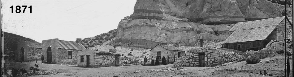
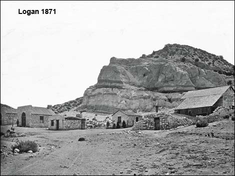 Logan in 1871 |
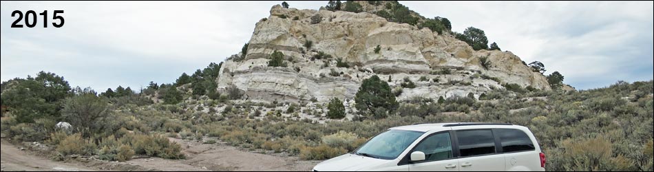
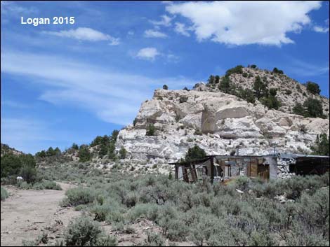
Logan Townsite In 1865, prospectors learned of and tried to work silver deposits on the southeast side of Mt. Irish, but the established residents, Southern Paiute Indians, drove them away. In 1866, more prospectors arrived, used violence to drive off the Paiutes, and worked the silver mines. In that year, the town of Logan City was established near a spring. The town grew to a population of 300 and had a post office (making it an official town). The town was abandoned three years later (1869) when more productive mines opened near Pioche. Starting in the 1950s, two residences were built, partially using remains of the previous town, but these too were abandoned. Today, the area is silent except for the wind and noisy Pinyon Jays. Sagebrush has regrown, Utah Junipers dot the landscape, and most of the old stone buildings are gone. What remains, stone walls, cement foundations, and rusty cans, remind us of life during earlier times. There are five parts to this area: Schofield House, Wooden House, Historic Stone Cabins, Logan Spring and Habitation Sites, and Historic Cabins and Tent Sites on the Hillside. |
 Same shot, Logan in 2015 |
Getting to Logan Townsite Logan Townsite is located in the southern part of Basin and Range National Monument, about 2-1/4 hours (120 miles) northeast of Las Vegas driving directly, or about 45 minutes (13.1 miles) northwest of the intersection of Highway 93 and Highway 318. From Las Vegas, drive north on Interstate-15 21 miles to Highway 93. Turn left onto Great Basin Highway (Hwy 93) and top off the gas tank if necessary. Drive north past the towns of Alamo (95 miles from Las Vegas) and Ash Springs (102 miles) to the intersection of Highway 93 and Highway 318 (107 miles). Gasoline is available in Alamo, Ash Springs, Rachel, and Lund. Turn left onto Highway 318 and drive west then north on Highway 318 for 3.1 miles to Logan Canyon Road on the left. The intersection is marked only by a wire fence gate. Open and be sure to close the gate, then drive west on Logan Canyon Road 9.6 miles to an unsigned fork. Stay left 0.3 miles to Logan Townsite. |
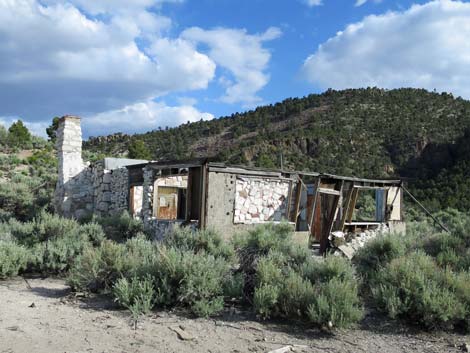
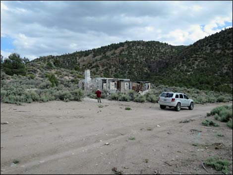
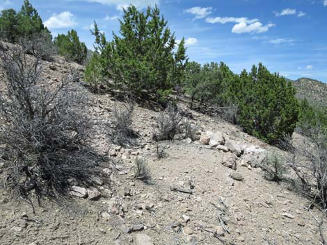
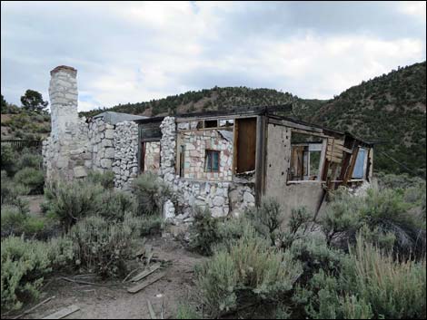 Schofield House Schofield House |
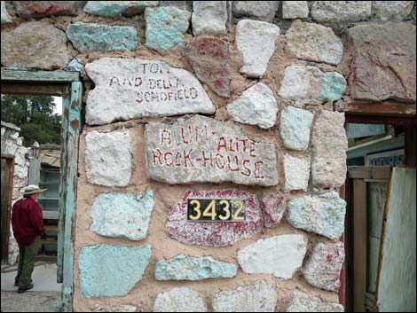
Robert Schofield, Carson City, NV, writes: The Stone House was built by my grandfather, Thomas Theron Schofield, of Las Vegas, NV. He started the project in the late 1950's. I helped him remodel it in 1968. Tom grew up in Hiko, NV, and was a prospector in the area for many decades. |
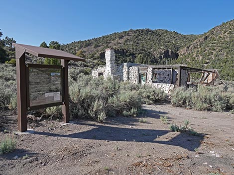 |
Text on the Logan Townsite Kiosk Sign Logan City Mining Camp Logan City was the largest of four mining camps established in the Pahranagat Mining District. In 1865, Logan Spring was home to the first official meeting for the District. Logan City quickly grew, and by 1867, there was a post office, store, hotel, stable, and a population speculated to be about 300. The boom was short-lived. Given the relatively poor silver production in the district, and promising discoveries found elsewhere, the town was abandoned by 1871. |
 |
Spring Logan Spring has attracted native Americans, miners, and ranchers for thousands of years and continued to be used long after the mining camp was abandoned. The most prominent individual at post-boom Logan city may have been Adin W. Geer, a rancher, farmer, and independent miner from Pahranagat Valley. Between 1889 and 1911, he developed a land patent on the area surrounding Logan Spring and used the water for mining, domestic purposes, and watering between 10 and 100 animals (probably cattle) year-round. |
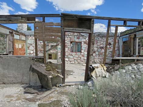
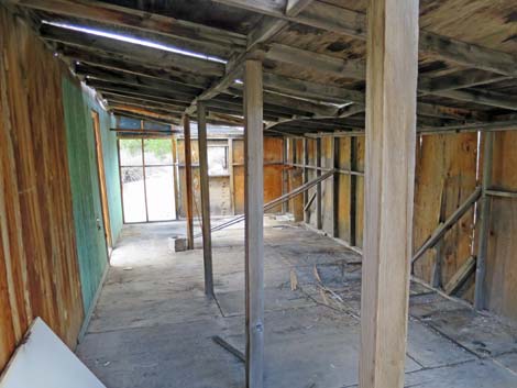
 Stone House ,inside the enclosed porch area (view E) |
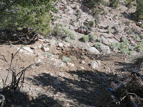
Where are all the buildings? Due to the continuous reuse of materials at Logan City by later miners and ranchers, the original camp structures are unrecognizable today. By 1970, the only buildings standing at Logan City were part of the Schofield home. These buildings were constructed with re-purposed materials and plywood. The Schofields started mining aluminum silicate deposits in the banded rhyolite bluff overlooking Logan City in 1955. There are rock piles and walls scattered across the area that outline the locations of previous structures, but their actual dates of use are unknown. |
 Stone House (view E) |
Pahranagat Mining District Logan city was part of the Pahranagat Mining District. The District was established in 1865 after a local Native American confirmed that silver ore could be found at Mt. Irish. Between 1866 and early 1867 the district peaked in silver production and had a population of approximately 500. By 1868, it was estimated that nearly a million dollars had been spent in the district but only $20,000 in bullion had been shipped. With resources drying up and new strikes made in nearby Panaca and Pioche, the Pahranagat Mining District population dwindled. In 1869, William Raymond and his partner John Ely, who had owned the largest mines in the district, dismantled their stamp mill at Hiko and moved it to Bullionville near Pioche. In 1871, the county seat moved from Hiko to Pioche punctuating the end of the Pahranagat Mining District. After the bust, prospectors continued to try their luck by collecting small pockets of ore overlooked by earlier developments, but the Pahranagat Mining District never experienced a true revival. |
Schofield House (more photos of the Schofield House)
 Stone House (view S) |
 Stone House (view N) |
Wooden Cabin (more photos of the wooden cabin)
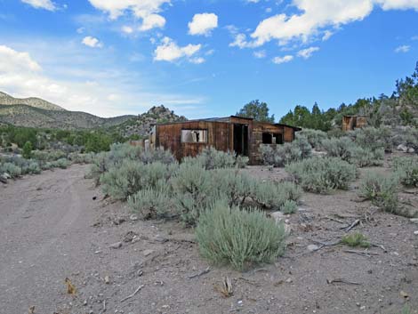 Wooden House exterior (view N) Wooden House exterior (view N) |
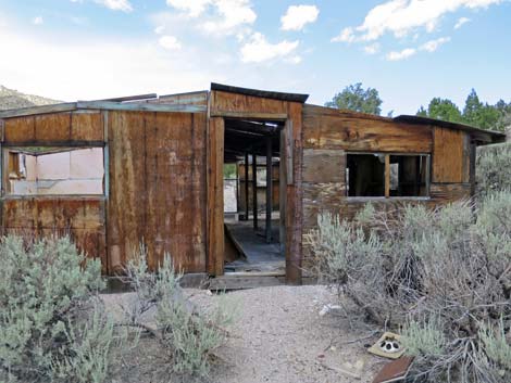 Wooden House exterior (view N) |
 Wooden House interior (view N) |
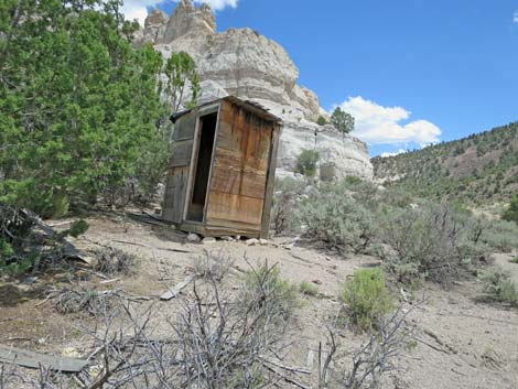 Outhouse on the hill behind the wooden cabin (view SE) |
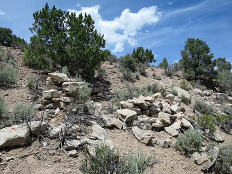
Historic Stone Cabins (more photos of these cabins)
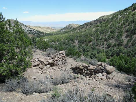
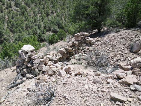
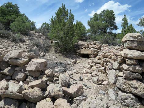
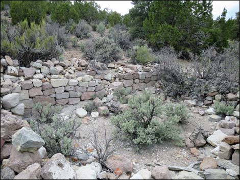 Historic Building Ruins |
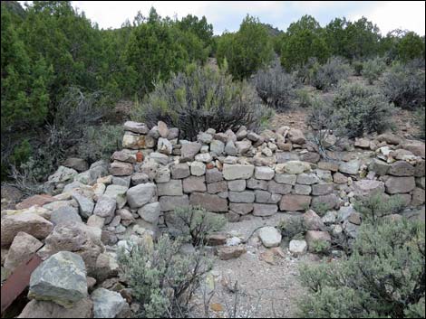 Historic Building Ruins |
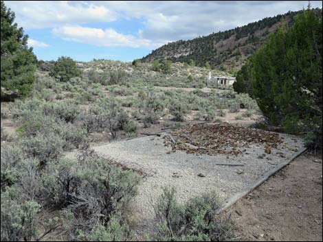 Historic Building Ruins |
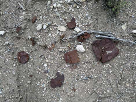 Metal debris |
Logan Spring and Habitation Sites (more photos of this area)
 Logan Spring, which sustained the town |
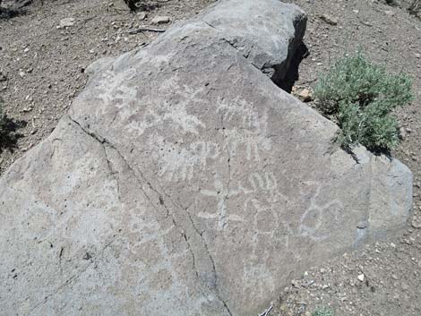 Marks on the stone |
 Habitation sites |
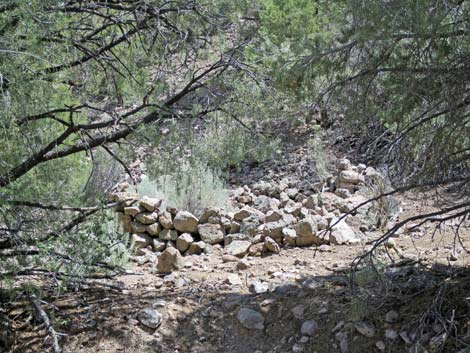 Habitation sites |
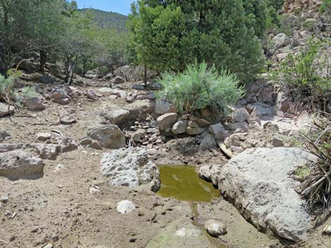
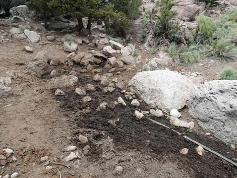 Upper spring is nearly dry in 2021 |
 Looking down on nearly dry Upper spring in 2021 |
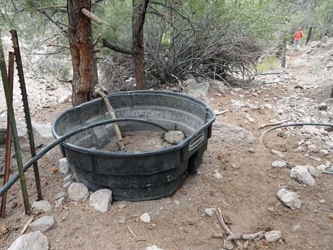 Abandoned cattle trough in 2021 |
 More to come ... |
Historical Cabins and Tent Sites on the Hillside (more photos of this area)
 |
 |
 |
 |
Happy Hiking! All distances, elevations, and other facts are approximate.
![]() ; Last updated 250614
; Last updated 250614
| Basin and Range | Backroads | Hiking Around Las Vegas | Glossary | Copyright, Conditions, Disclaimer | Home |