Hiking Around Las Vegas, Mojave National Preserve

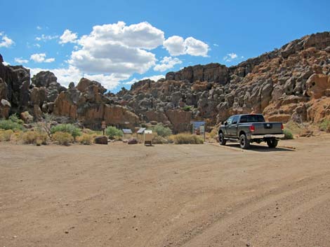 Rings Trailhead (view W) |
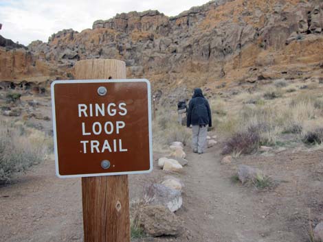
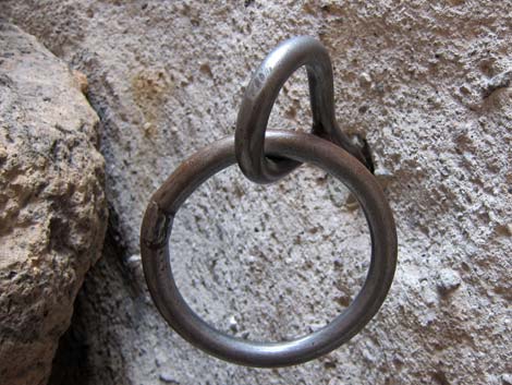
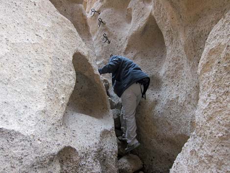
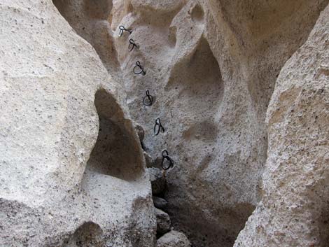
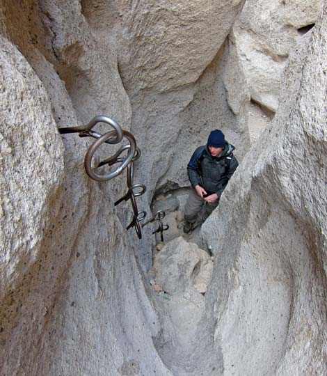
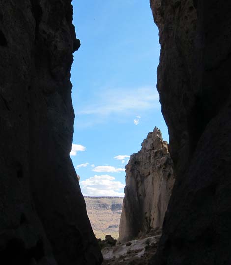
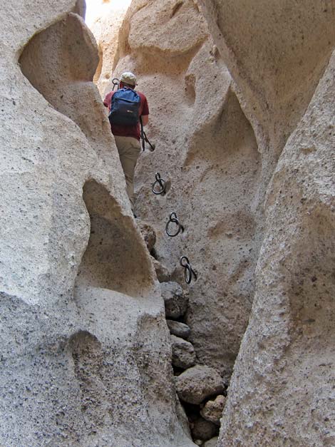
Overview This short route drops through Banshee Canyon (a narrow cleft in the rocks) following a watercourse from the Hole-in-the-Wall picnic area to the desert floor some 100 feet below. This route is interesting simply because of the narrow cleft and the unusual geology, but also because of the ringbolts installed for hand and footholds in the rock walls where the route descends steep, smooth pour-overs. For those who don't want to climb down through the 3rd-class cleft, there is an overlook into another narrow canyon where you can yell to the people (but not see them) who do climb down the rings. Link to map. |
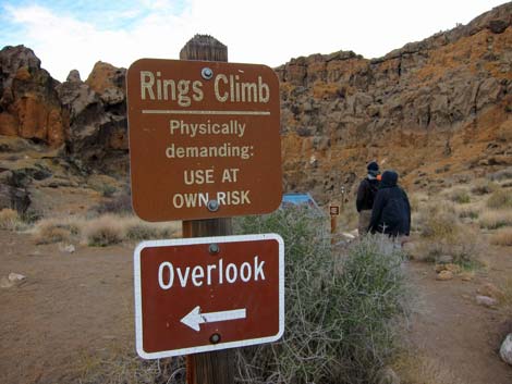 Trailhead warning and sign to overlook |
Watch Out Other than the standard warnings about hiking in the desert, ... this is a pretty safe hike except that hikers could fall on the steeper, 3rd-class sections of the route. There are two sets of ringbolts for handholds, but hikers could fall as much as 10 feet, and there are several other section of scrambling. Watch the kids at the overlook and throughout the hike. The Ringbolt route requires a little balance and agility. While hiking, please respect the land and the other people out there, and try to Leave No Trace of your passage. Also, even though this is a short hike, be sure to bring what you need of the 10 Essentials. |
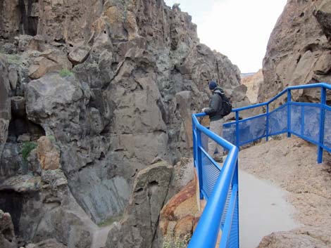 Overlook with barrier fence |
Getting to the Trailhead This hike is located in Mojave National Preserve, about 2 hours south of Las Vegas. From town, drive out to Hole-in-the-Wall Visitor Center, which is about 85 miles south of town. From the Visitor Center, continue west on Hole-in-the-Wall Road for a minute or so to Rings Trailhead at the end of the road. Park at the western-most point on the road; this is the trailhead. |
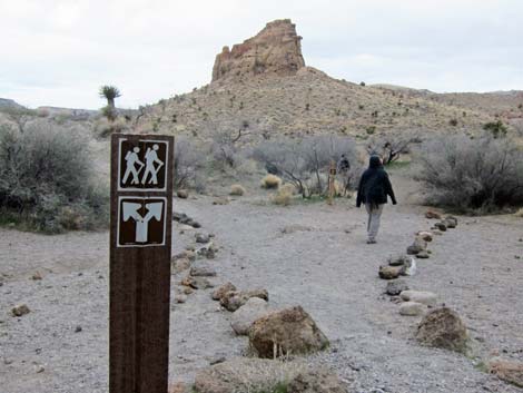
 Rings Trail trailhead |
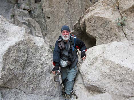
The Hike There are two parts of this hike: the short overlook trail and the Ringbolt route. First, at the trailhead, read the interpretive signs, then go over to the overlook and look down into the canyon. Second, scramble down Banshee Canyon climbing down the ringbolts to the bottom of the canyon, which opens onto desert flats. There is a way to get up into the canyon below the overlook, but without a little rock climbing, you can't actually see the overlook from below. From the trailhead (Table 1, Waypoint 01), the trail runs south for less than 1 minute to the overlook. This short trail leads through a break in the rocks to an overlook at the top of a cliff. Guardrails and fences at the edge keep everyone safe. |
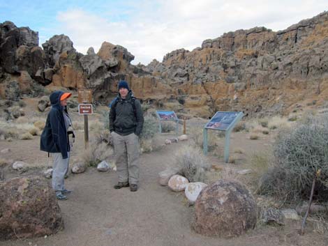 Hikers at Rings Trail trailhead |
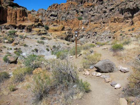
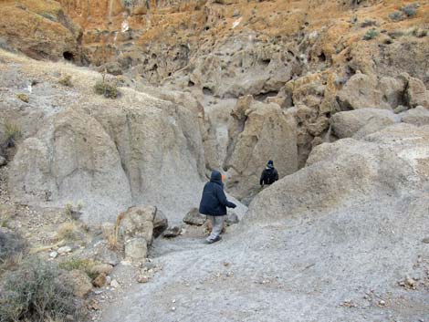
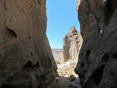
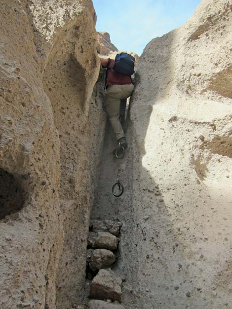
To scramble down the Ringbolt route, walk west from the trailhead for about 1 minute or so. The trail drops into a narrow, rocky canyon that gets narrower and steeper the farther you go. Follow the canyon down through the cleft, using two sets of ringbolts for hand and footholds on pour-overs in the steepest sections of the route. When the route breaks out of the cleft and hits the dirt at the bottom of the canyon (Wpt. 02), continue downhill for another minute or two. The route passes an historic check dam used to catch water for cattle, then passes out of the cliffs into open desert. At a signed fork in the trail (Wpt. 03), the left trail (Rings Loop Trail) will wrap around the cliffs and leads back to the ranger station, while the right (Barber Loop Trail) connects with trails leading as far as Mid Hills Campground. To get back to the trailhead, retrace the route and climb back up the ringbolts, or continue down and around the cliffs to the south on the Rings Loop Trail (see photos at the bottom of the webpage). |
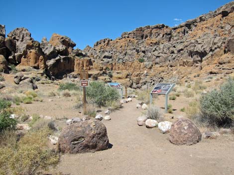
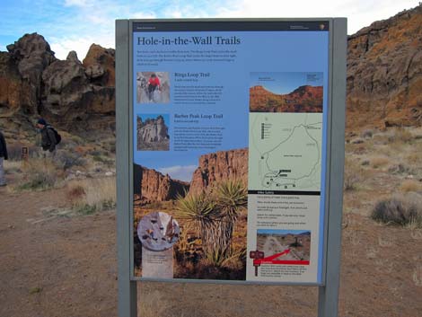 Trail information sign |
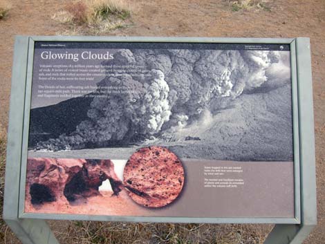 Sign about geology |
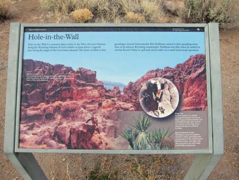 Sign about local history |
 Starting on the Rings Loop Trail |
 Trail runs towards canyon (view W) |
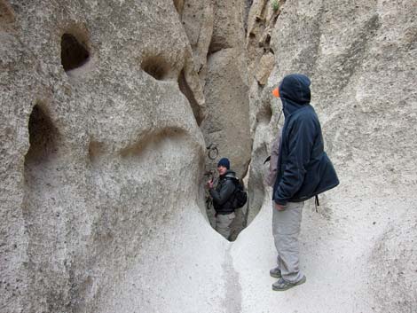
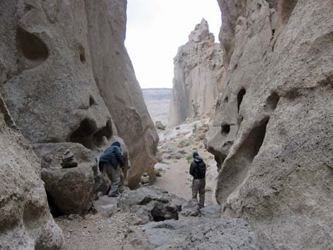
 Trail drops into Banshee Canyon (view NW) |
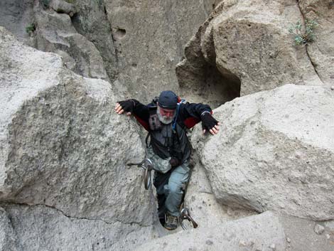
 Hikers descending into Banshee Canyon (view NW) |
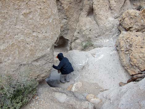 Hiker climbing down Banshee Canyon |
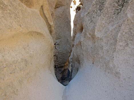
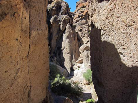 Narrow Banshee Canyon |
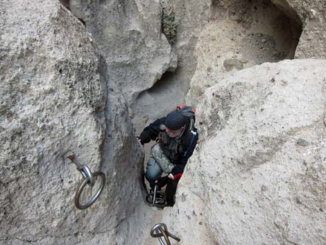
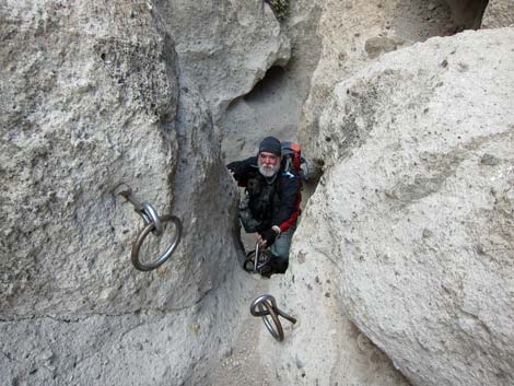
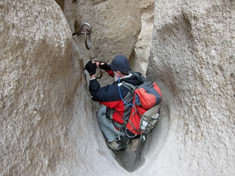
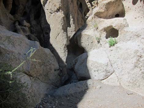 Arriving at upper ringbolts |
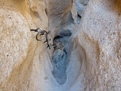
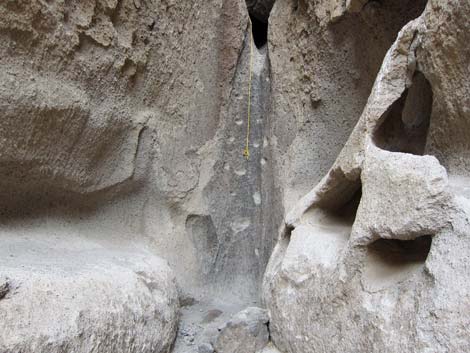
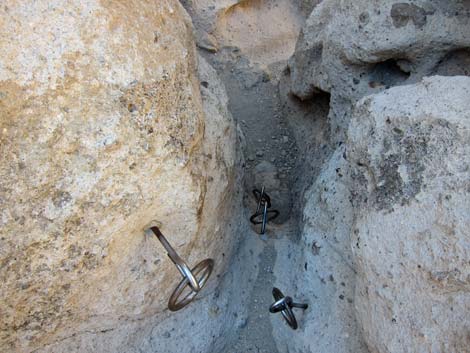 upper set of ringbolts |
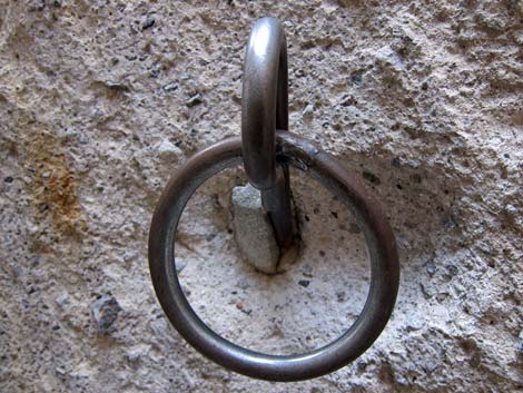
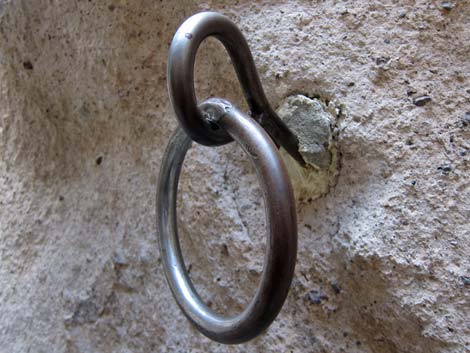 Ringbolt |
 Starting down the upper ringbolts |
 The narrow slot is a bit awkward with a backpack |
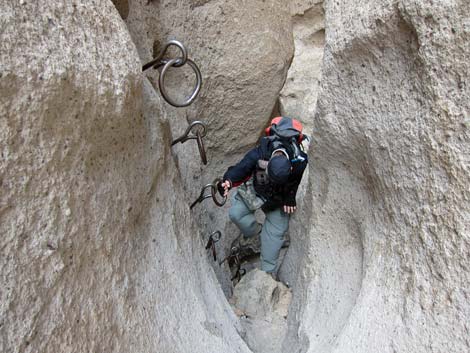
 Climbing down the upper ringbolts |
 Climbing down the upper ringbolts |
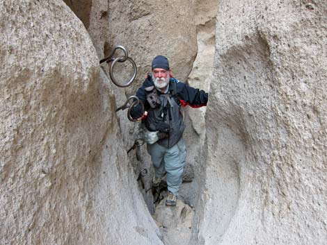
 Hikers above and below the upper ringbolts |
 Arriving at lower ringbolts |
 Arriving at lower ringbolts |
 Hiker starting down the longer, lower ringbolts |
 Hiker descending the lower ringbolts |
 Hiker descending the lower ringbolts |
 Ringbolt |
 Ringbolt |
 Hiker finishing second set of ringbolts |
 Looking back up second set of ringbolts |
 |
 |
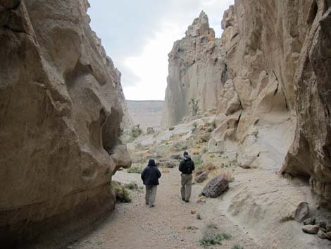 Hikers emerging from the cleft (view SW) |
 Canyon becomes wider (view SW) |
 To the left is a way to get up below the overlook |
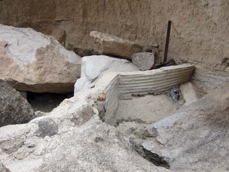 Historic check dam to catch water for cattle |
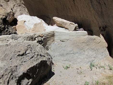 Historic check dam to catch water for cattle |
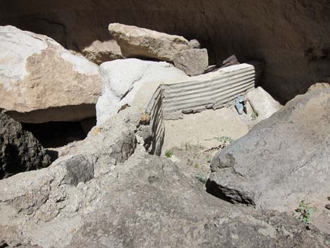 Historic check dam to catch water for cattle |
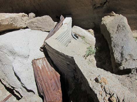 Historic check dam to catch water for cattle |
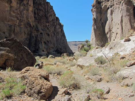
 View into the open desert |
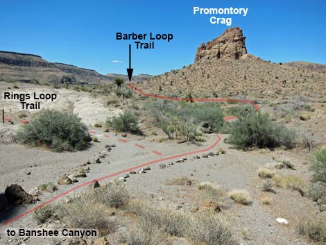 Fork in trail; end of the Banshee Canyon route (going right) |
 Hiker at fork in trail (going right) |
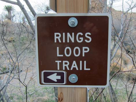 Sign for Rings Loop Trail to the left (view W) |
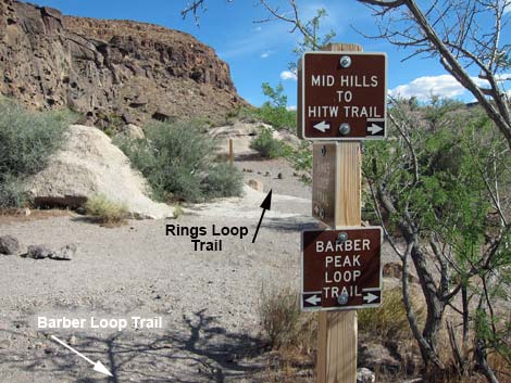 Other side of the post: sign for other trails (view S) |
 Hiker below lower ringbolts |
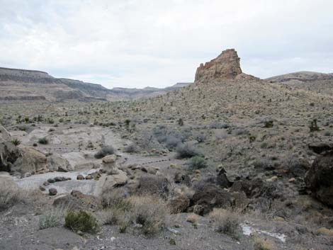
 Crags and desert flats beyond the Hole-in-the-Wall (view SW) |
 Return to trailhead by climbing back up the ringbolts (view NW) |
 Return to trailhead by climbing back up the ringbolts (view NW) |
Table 1. Hiking Coordinates Based on GPS Data (NAD27; UTM Zone 11S). Download Hiking GPS Waypoints (*.gpx) file.
| Wpt. | Location | UTM Easting | UTM Northing | Elevation (ft) | Point-to-Point Distance (mi) | Cumulative Distance (mi) | Verified |
|---|---|---|---|---|---|---|---|
| 01 | Trailhead | 646177 | 3878898 | 4,256 | 0.00 | 0.00 | GPS |
| 02 | Bottom of Cleft | 646079 | 3878812 | 4,182 | 0.17 | 0.17 | GPS |
| 03 | Trail Junction | 646020 | 3878753 | 4,163 | 0.05 | 0.22 | GPS |
| 01 | Trailhead | 646177 | 3878898 | 4,256 | 0.22 | 0.44 | GPS |
Happy Hiking! All distances, elevations, and other facts are approximate.
![]() ; Last updated 240329
; Last updated 240329
| Hiking Around Mojave Preserve | Hiking Around Las Vegas | Glossary | Copyright, Conditions, Disclaimer | Home |