Hiking Around Las Vegas, Lake Mead National Recreation Area
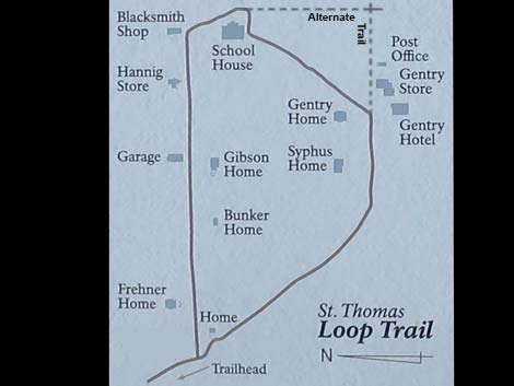 St. Thomas Townsite map seen on some signs along the trail. "You are here" is marked on these maps. Alternate trail added to the original. |
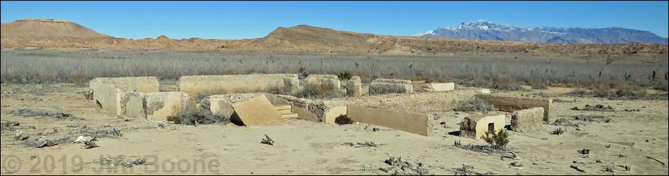
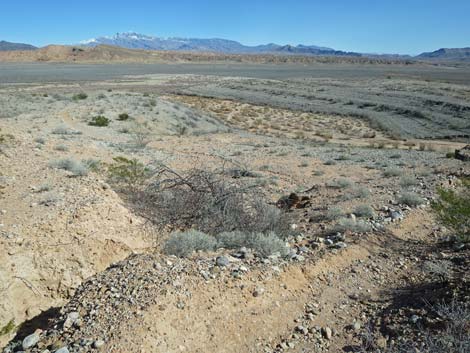
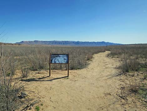
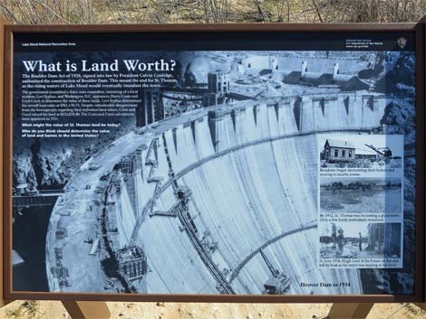
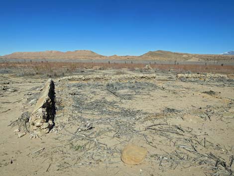
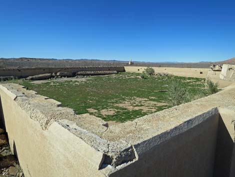
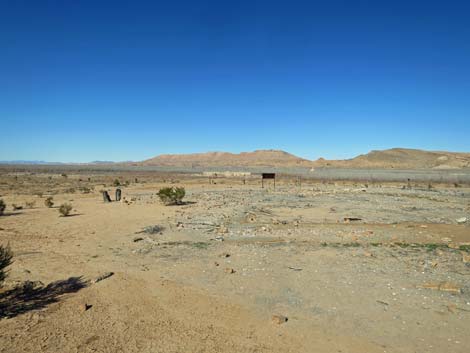
Overview St. Thomas was a pioneer town on the Muddy River, just upstream from the confluence with the Virgin River, that was settled by Mormons pioneers in 1865. Church leaders sent about a dozen men and women to colonize this area as a stop-over place along the freight route between the Colorado River and Salt Lake City, as this would facilitate international commerce in what they hoped would be the new nation of Deseret. The town increased as locally-grown farm products and mineral ore from nearby mines were shipped out, but the town never flourished. One part-time resident of St. Thomas described it, in her later years, as a "hell hole" that she was happy to leave. After completion of Hoover Dam, the town flooded in 1938. Droughts in the Colorado River Basin caused lake levels to fall a few times and temporarily expose the town, but it remained submerged for many years. By 2007, climate-change induced drought dropped the lake level and exposed the historical townsite. Now, the ghost town that once was beneath 70 feet of water, is accessible by trail with a short descent from the trailhead to the nearly level floor of the former lake. Learn more about historical St. Thomas. |
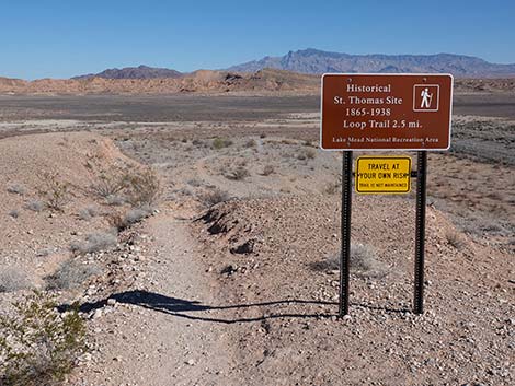
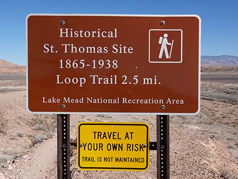
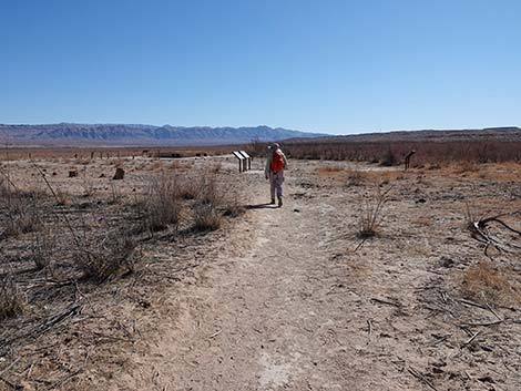
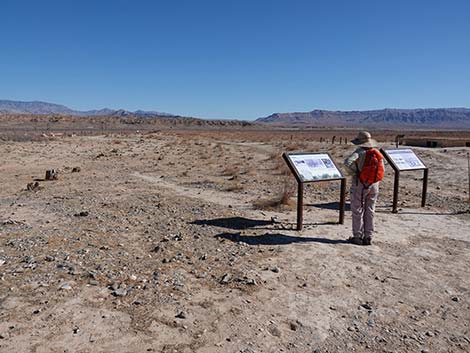
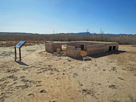
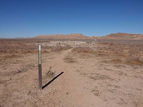
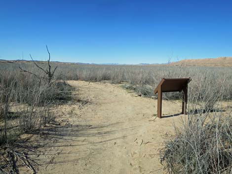
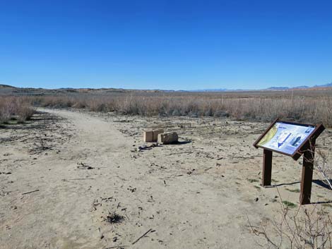
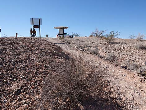
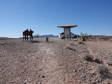
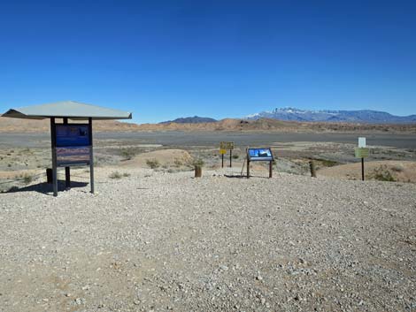 St. Thomas trailhead with several signs (view E) St. Thomas trailhead with several signs (view E) |
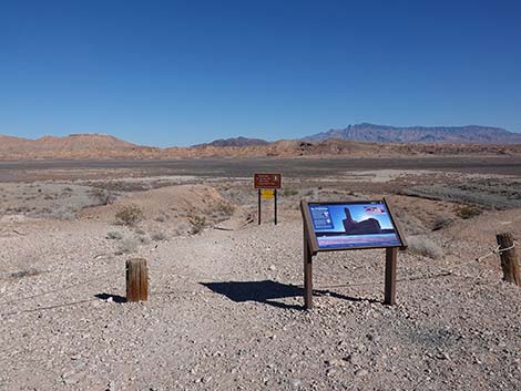
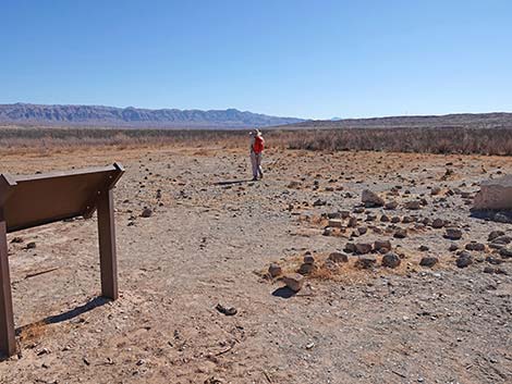
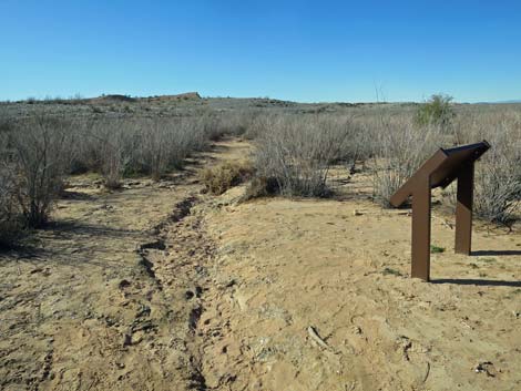
Link to topo map or aerial photo map. Watch Out Other than the standard warnings about hiking in the desert, ... this is a fairly safe area. The hike down to the lake-bottom flats is somewhat steep with loose gravel and rounded rocks in the trail, and parts of the trail wash out during flooding events. Please respect the historical nature of this site. Enjoy whatever you find, but leave things behind for the next person to discover, and resist the urge to pile up things for others to find it more easily. Don't climb on the structures because you could damage them. While hiking, please respect the land and the other people out there, and try to Leave No Trace of your passage. Also, this is a fairly short hike, so just bring what you need of the 10 Essentials. |
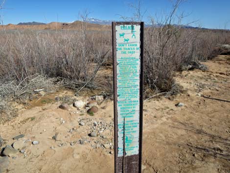
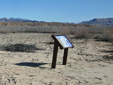
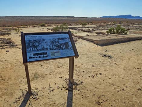
 Sign-01: St. Thomas trailhead information (view E) |
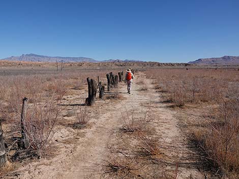
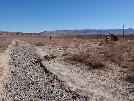
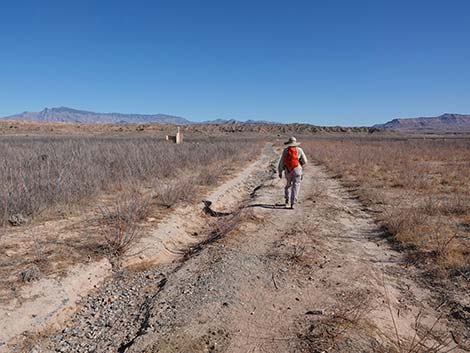
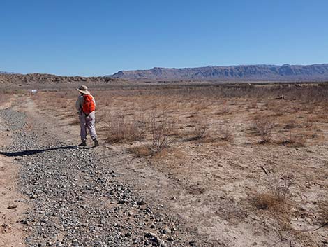
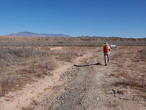
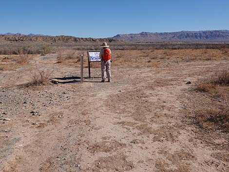
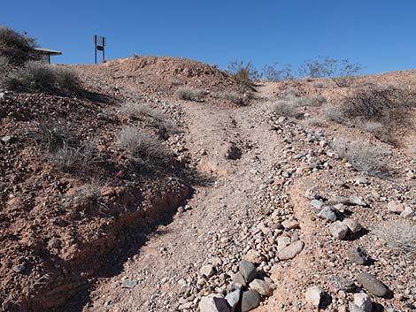
Getting to the Trailhead This hike is located along Northshore Road in Lake Mead National Recreation Area, about 1.5 hours northeast of Las Vegas. From town, drive out to Lake Mead via Northshore Road, through Valley of Fire State Park, or via Interstate-15 and the town of Overton. From the North Entrance (fee) Station for Lake Mead NRA, drive northeast on St. Thomas Cove Road for 3.5 miles to the St. Thomas Trailhead at the end of the road (stay right at a fork). Park here, this is the trailhead. The left fork runs out to a vault toilet. |
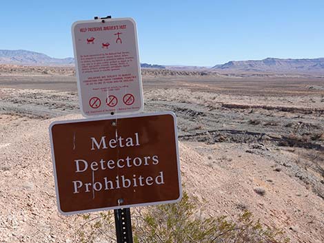 Be sure to help protect this site for future generations |
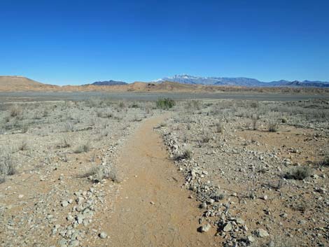
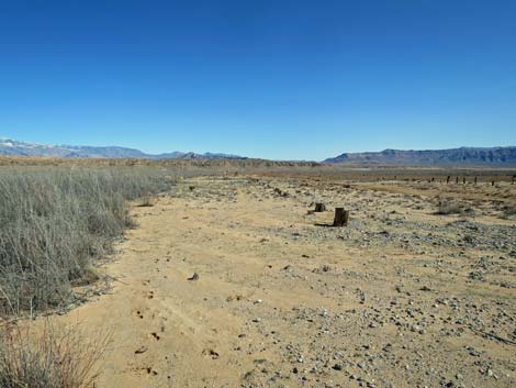
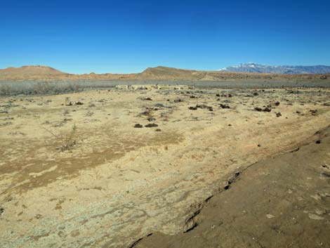
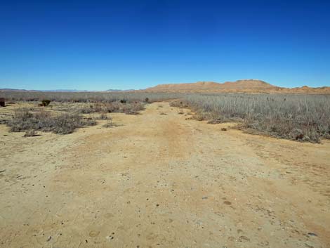
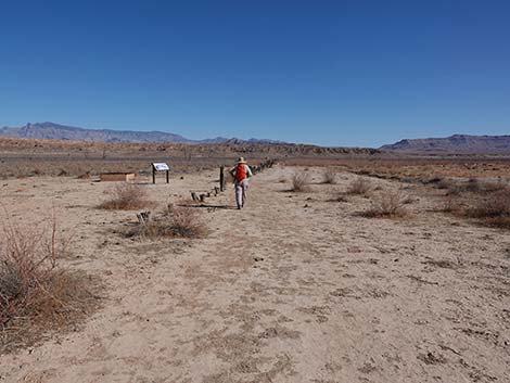
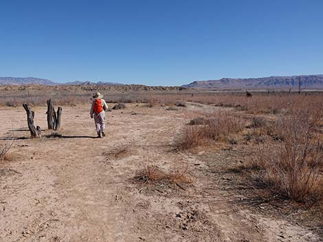
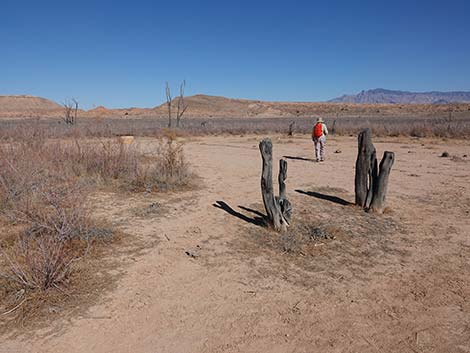
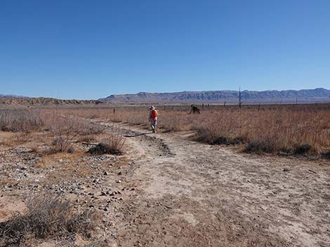
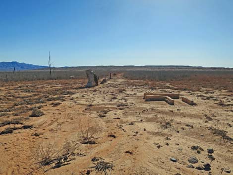
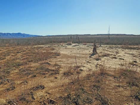
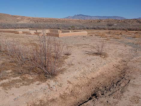
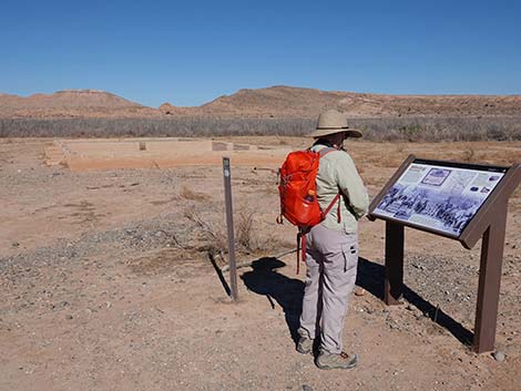
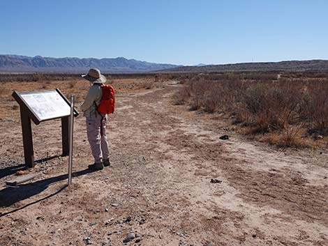
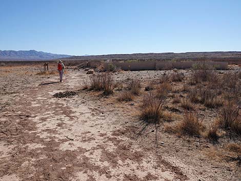
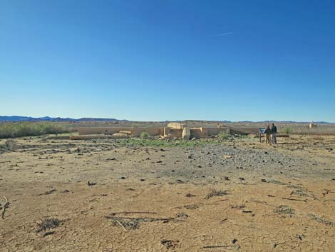
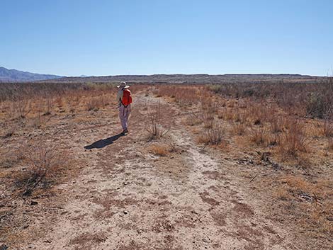
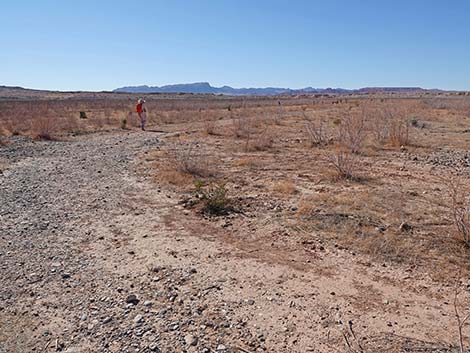
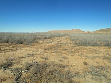
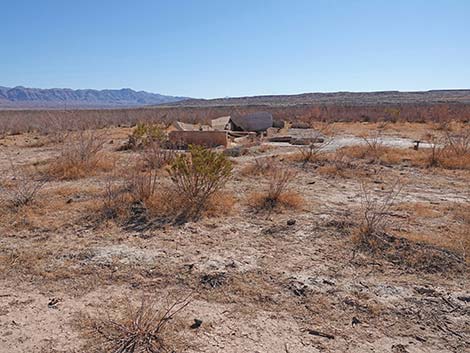
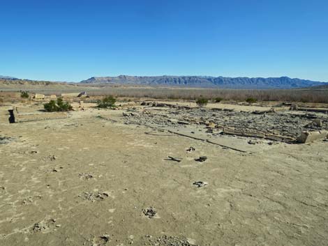
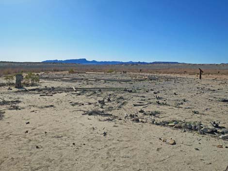
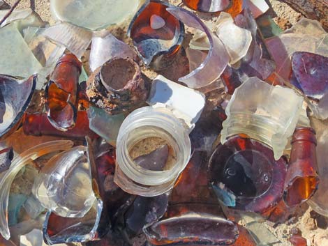
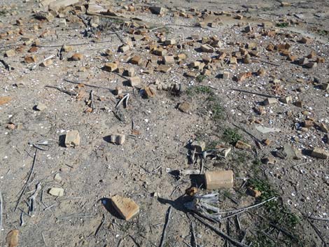
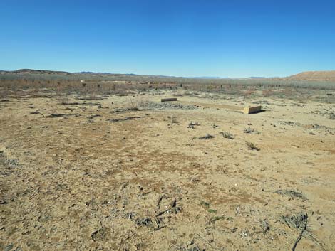
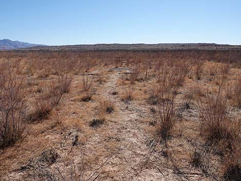
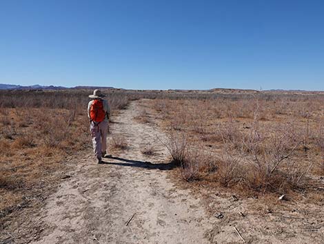
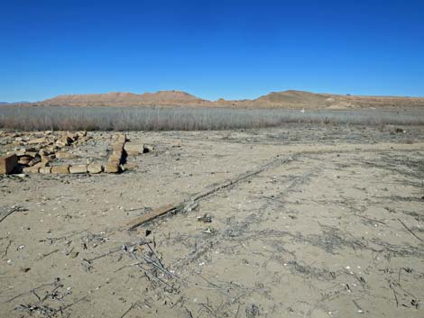
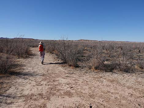
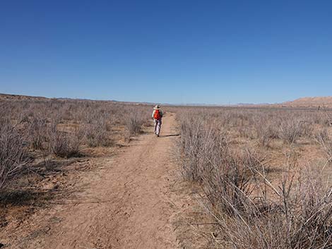
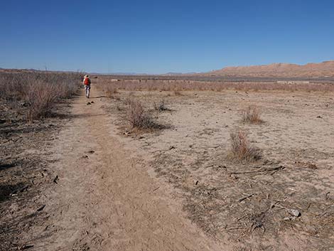
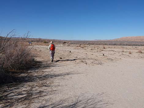
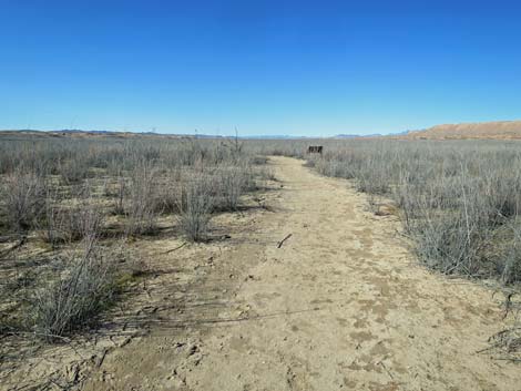
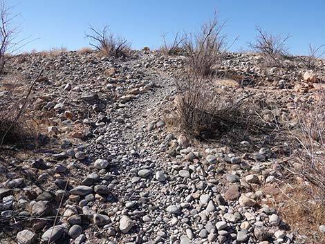
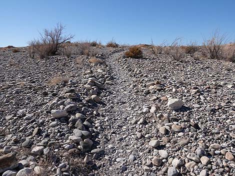
The Hike From the trailhead (Table 1, Waypoint 01), the St. Thomas Trail runs east past an information kiosk and various trailhead signs (including Sign-01) to the edge of dirt bluffs. The trail immediately switchbacks down to a lower level, then continues east until descending off the toe of the ridge to the lake-bottom flats below. Watch for rounded rocks on the toe of the ridge that roll underfoot like marbles and golf balls. On the lake-bottom flats (Wpt. 02), hikers are immediately surrounded by invasive saltcedar trees that moved in after the water receded. Saltcedar Leaf Beetles seem to be doing a good job of controlling these weeds, but it is a work in progress for them. Also of interest at the edge of the lakebed is the plethora of clam shells. Not to be expected in the desert, these freshwater clams are another invasive species that have invaded Lake Mead. As the water recedes, thousands of Asian Clam shells are exposed to the air and die, leaving their white shell scattered across the lakebed. |
 St. Thomas trailhead trail sign (view E) |
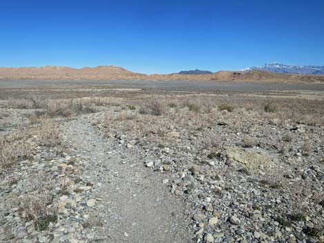
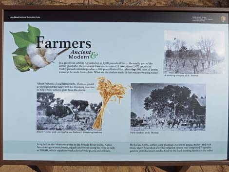
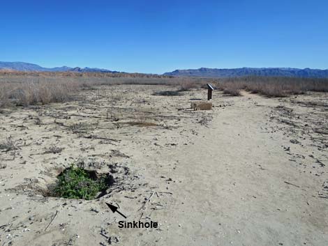
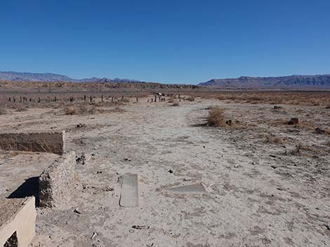
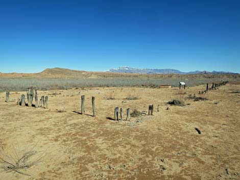
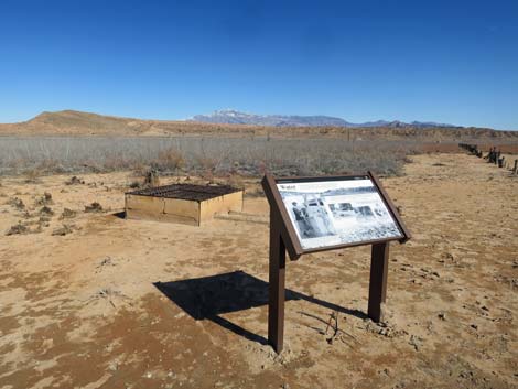
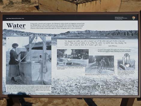
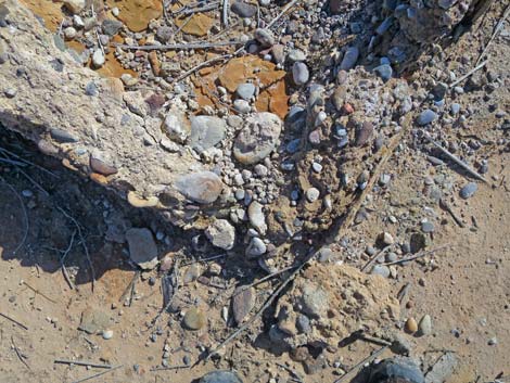
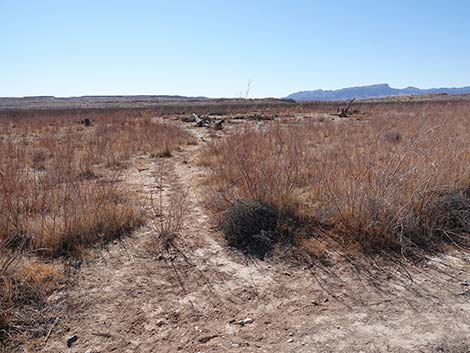
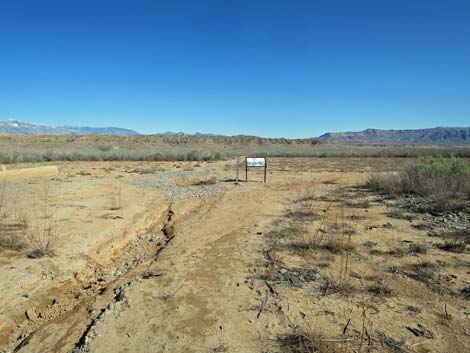
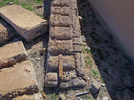
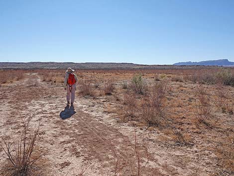
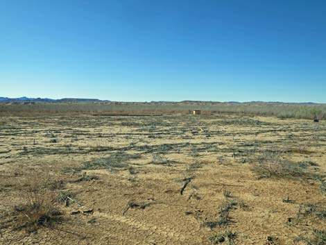
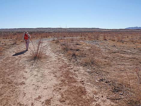
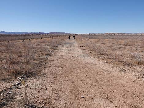
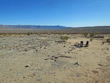
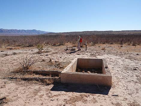
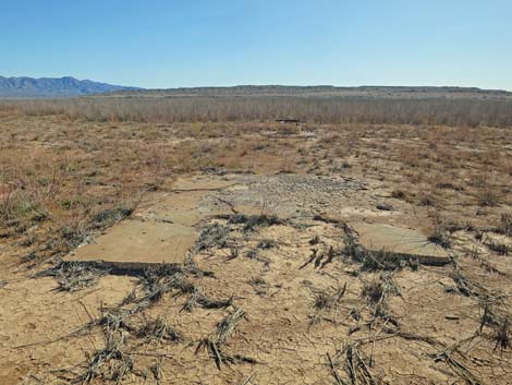
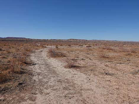
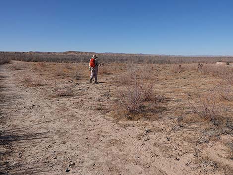
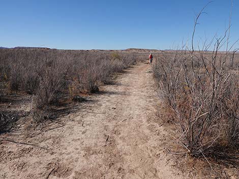
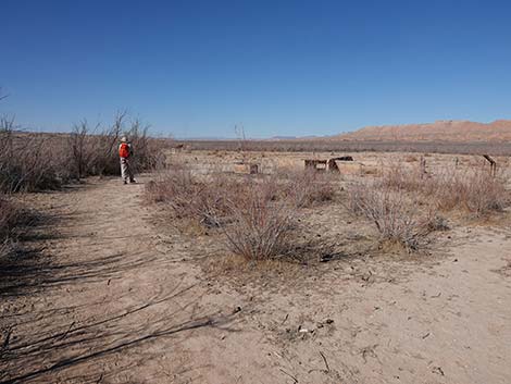
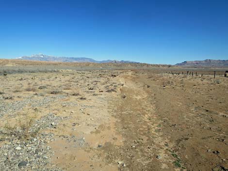
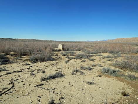
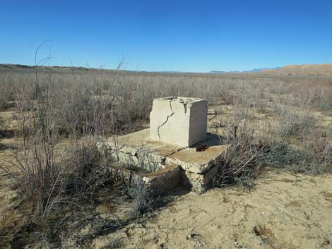
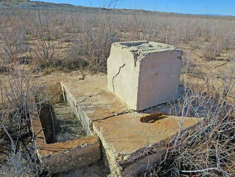
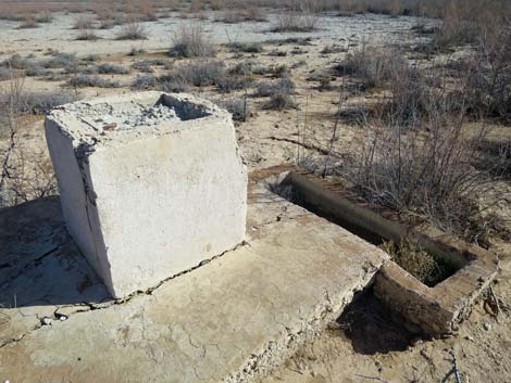
Continuing, the trail bends south to follow the base of the hills, then cuts across an outwash area where flooding has come through and erased part of the trail. Even so, it is easy to follow the path through the saltcedar thicket. The trail reaches the toe of the next ridge and encounters an information sign. Sign-02 provides information on crops and farming in the area. Native people grew corn, beans, squash, and cotton as early as AD 900. Some 900 years later, Europeans grew cotton, grapes, grains, and vegetables. Not mentioned here, the original Mormon settlers grew cotton for export to Salt Lake City. From Sign-02, the trail crosses below the toe of a low ridge, then bends a bit left and starts out onto the lake bottom flats. Before long, hikers approach the next information sign. Shortly before the sign, there is a small sinkhole off the left edge of the trail. A few plants grow in the most soil, but one wonders: what lies below? Between the sinkhole and the sign, two concrete blocks sit on the ground. These appear to be blocks that would have lined an irrigation ditch. The blocks are set to show how a wooden board could be slipped into groves in the blocks to control water flow. |
 |
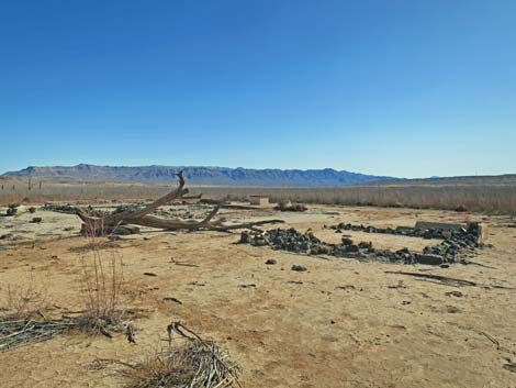
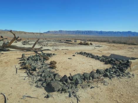
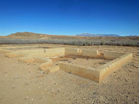
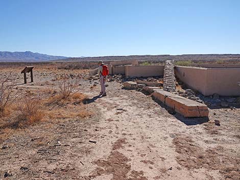
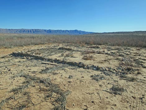
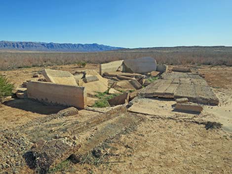
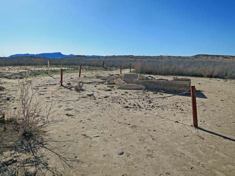
Sign-03 provides information on the history of state lines. Originally, this area was in Utah, but changes in state lines placed this town in Nevada. Unfortunately for the original Mormon residents, Nevada demanded back taxes in gold or silver, which the residents did not have because the Mormon economy was based on trade and barter, not cash. After a vote, most residents abandoned the town and returned to Utah. Frank Bonelli and one other (his wife?) stayed behind and eventually got rich off the loss of his neighbors mixed with his own hard work. Continuing on the trail, hikers soon reach the first visible building ruin along the trail. The Roxton Whitmore home sits off the left side of the trail behind a pipe-and-cable fence. The house is small, but the two cottonwood stumps indicate that there was plenty of summer shade for living outside. Just beyond the Whitmore home, hikers encounter the next information sign. Sign-04 provides information about how the federal government bought out the residents before their homes were flooded by the rising water of Lake Mead. Residents were paid a bit more than $800,000 for their hopes, dreams, sweat, memories, and homes. |
 Starting down, the trail immediately switchbacks right (view E) |
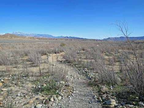
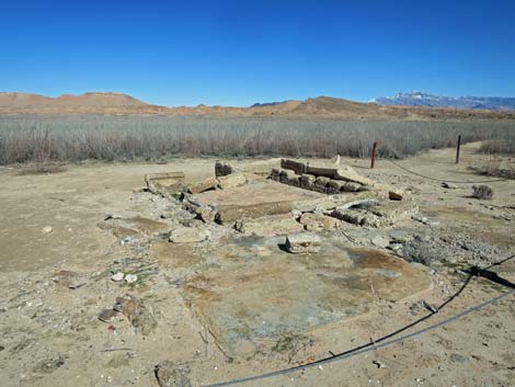
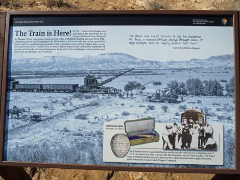
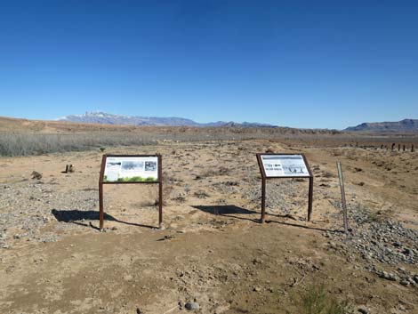
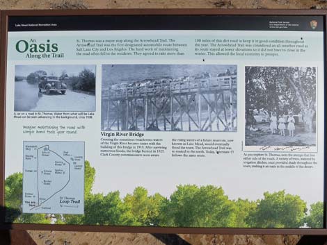
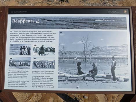
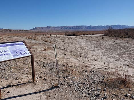
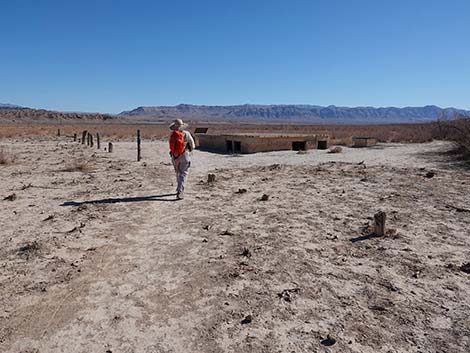
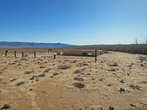
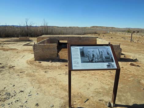
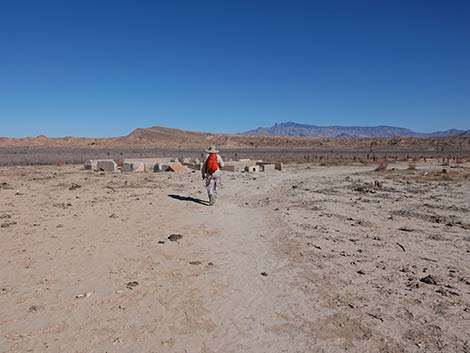
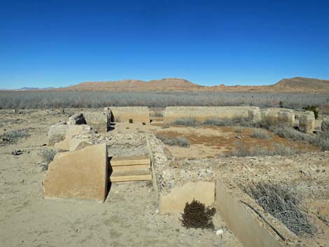
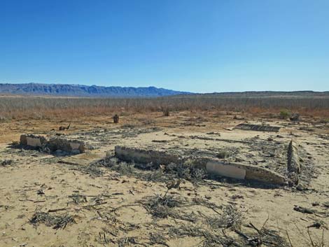
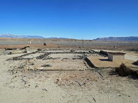
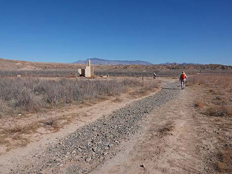
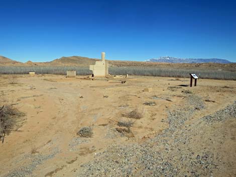
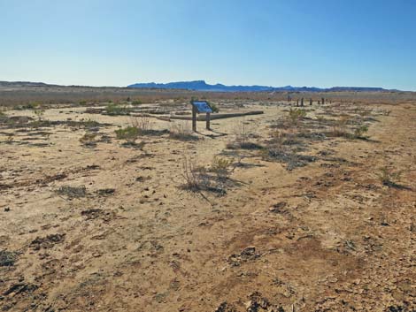
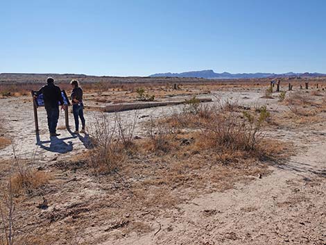
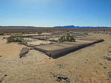
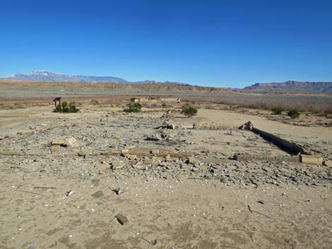
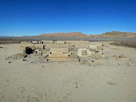
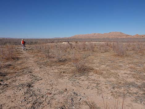
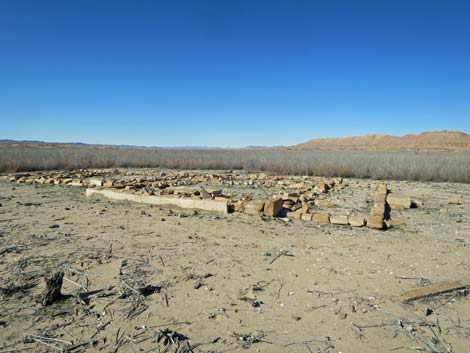
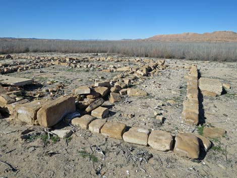
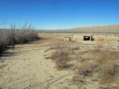
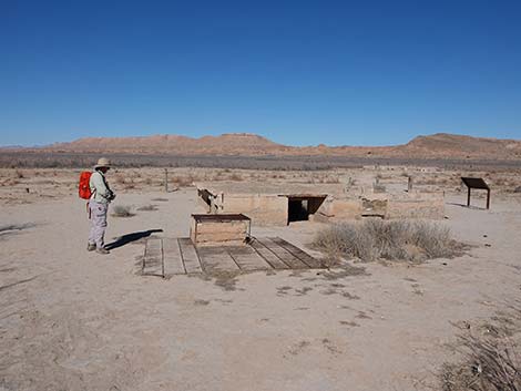
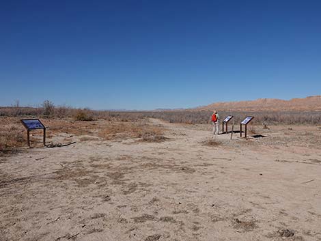
From Sign-04, the trail runs southeast through the saltcedar thicket until encountering three information signs at the edge of a large, cleared area (Wpt. 03). The cleared area is where the Park Service has cleared the saltcedar to reveal the remains of town. This point is along what was the main street through town. The first sign on the left, Sign-05, provides information about rising water: water flooding the Arrowhead Highway, the bridge over the raging Virgin River, and water for trees that provide welcome shade. This is the first of the signs that includes a "you-are-here map" of the townsite area. The second sign on the left, Sign-06, provides information about water; falling waters and the resurrection of town. Three times previously (1945, 1948, and 1965) town emerged from the waters, but each time the water came back. The third sign, this one on the right, provides information about the railroad, which arrived in town in 1912. With improved transportation, farm products and mineral ores could be shipped more quickly and profitably, plus perishable materials could be shipped in. |
 Trail runs out a flat ridgeline (view E) |
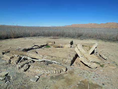
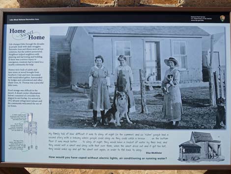
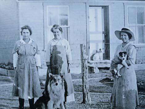
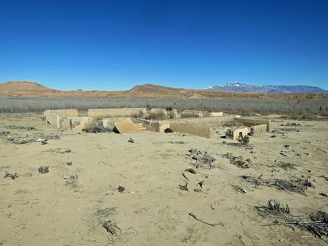
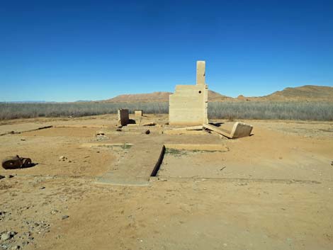
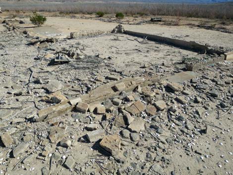
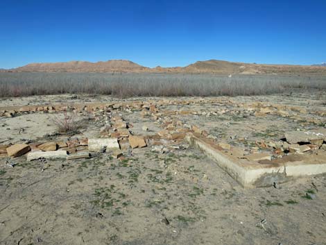
From the three signs, the main trail turns left and heads east along the main street through town (also the Arrowhead Highway). Immediately on the right (south side of the street), hikers encounter the ruins of the Fenton Whitney home. The walls still stand, but the home is half buried in mud giving the appearance of windows at ground level. There is a cistern next to the house. The opening is grated, but so is the ground around the opening; perhaps it was a cave-in hazard. Other cisterns here are not grated in this way. There is a sign here, Sign-08, that provides information on the home life and daily struggles of living in St. Thomas. The photo on the sign does not seem to be the house here, but the three ladies and their dogs are captivating in a way that brings the past to life. Continuing east on the main road, another ruin is visible on the left (north) side of the road. This is the Frehner house, and it, like the rest of the ruins here, are not so buried in mud. Here, the striking feature are the steps. One wonders how many footsteps they saw in their day. |
 Trail on ridgeline, which gets rocky towards the end (view E) |
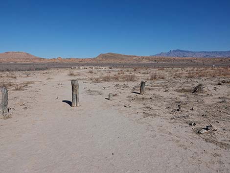
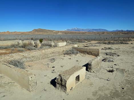
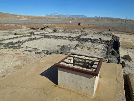
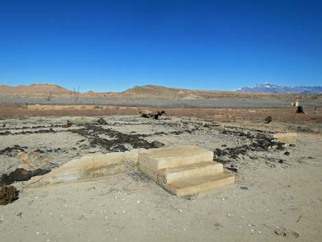
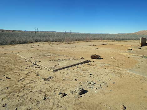
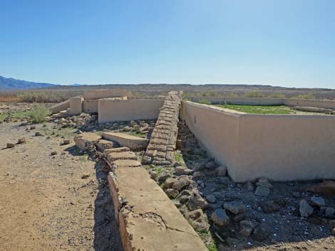
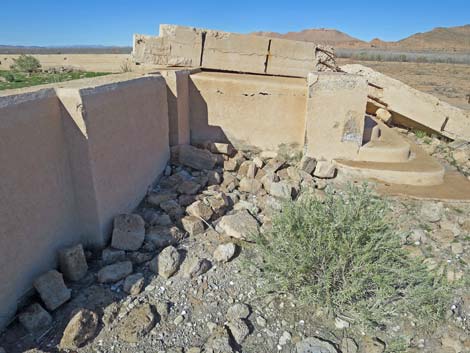
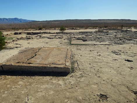
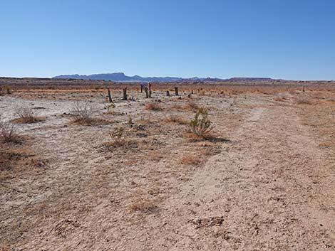
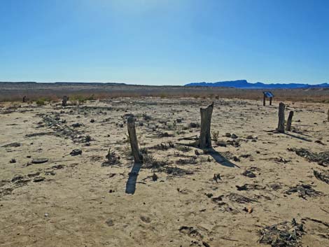
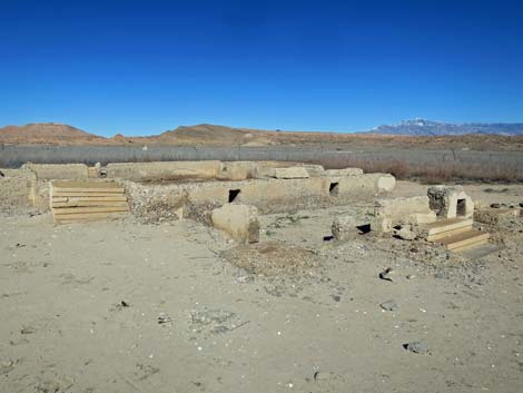
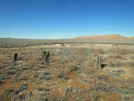
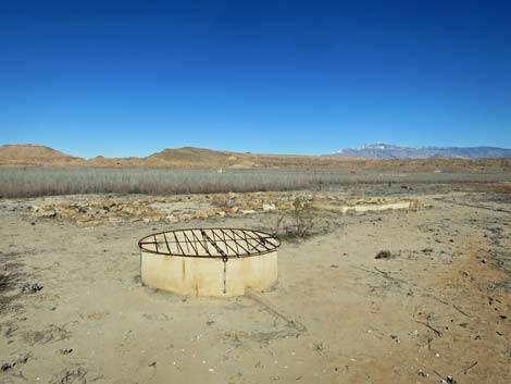
Continuing east on the main road, a side road left now serves a maintenance access to the area. Just beyond the side road, a yard or perhaps a pasture was fenced with small logs that could have been harvested from the local mountains. Some of these might have been living trees, but they look more like fence posts now. Inside this area is a large cistern and an information sign. Sign-09 provides information about the storage and use of water in town for farming and household purposes. The cistern seems to have a watering trough attached, so perhaps this was a pasture for livestock. Continuing east on the main road, the next ruin is on the right. Here, a foundation and the base of the walls of the RE Bunker house remain, plus a cistern out back. This house is interesting because the decomposing concrete reveals the use of lots of local rounded cobbles mixed into the cement. It seems the percentage of cobbles is rather high, perhaps explaining why the walls are decomposing. This house also shows signs of having sandstone slabs for flooring. When original, the sandstone floor must have been beautiful. |
 Trail descends onto former lakebed (view E) |
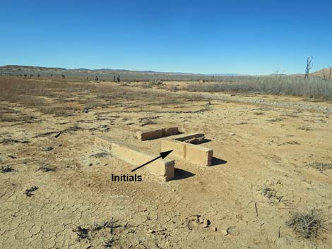
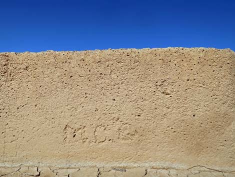
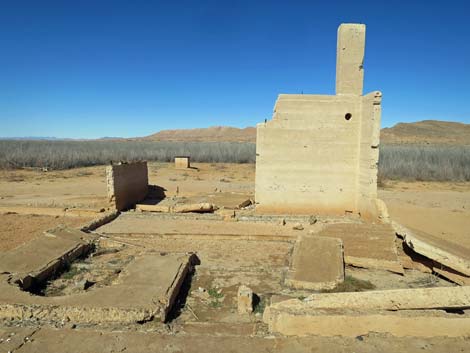
Continuing east on the main road, the next ruin is again on the right. Here, the Moses Gibson house seems to have had two buildings: a smaller outbuilding and a much larger main building. The interesting thing here is the incorporation of black volcanic rocks into the construction of both buildings; no other structure here uses them. From the height of the entry steps, perhaps these black stones were part of the foundation. These volcanic rocks may have come from the Cleopatra Volcano located just a few miles down the Virgin River from here. Just off the northeast corner of the Gibson house, there appears to be remains from the irrigation system, and here, someone scratched their initials in the wet concrete: MCG (Moses C. Gibson?). Across the main street from the Gibson house was the garage. This structure had a large flat floor with a cistern out back. Adjacent to the garage was Sellar's Cafe and Pool Hall, but the remains seem to be hidden in the saltcedar. |
 Signs along the trail (view SE) |
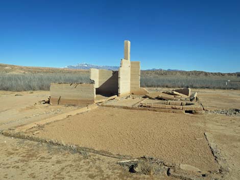
Across the street from Sellar's place was the JF Perkins place, but only a small bit of canal and the cistern seem to remain. Continuing east on the main road, the next ruin is on the right. Here was an important building in town, with an information sign about it. This was the Hannig (Haninnig?) Ice Cream Parlor, although it was actually a grocery store and gas station. Probably using ice brought in on the railroad, Hannig sold cold drinks, ice cream, and gasoline to travelers on the Arrowhead Highway. This structure is the only one remaining with part of the second story intact. The information sign out front, Sign-10, provides insight to the development of commerce along the dusty Arrowhead Highway and how local people, without much hard cash, created and managed their own form of paper currency. |
 Sign: protect our shared history (view SE) |
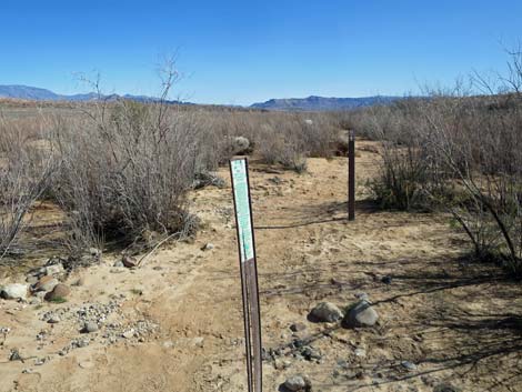
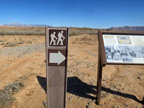
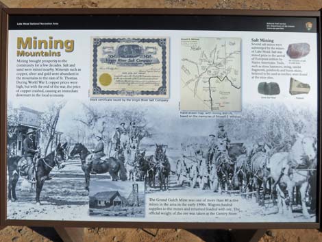
Down the main road just past the ice cream parlor, another information sign is visible. Here, Sign-11 (Wpt. 04) provides information about mining in the local mountains. Native people had mined salt from bluffs above the Virgin River forever, and these were taken over by people of St. Thomas. Gold Butte, just over the ridge to the southeast produced some gold and other minerals, and it attracted some 2,000 prospectors and miners, all of whom would have considered St. Thomas to be "town" and the source of food and mining supplies. Farther afield, the most profitable copper mine in northern Arizona lay just over the horizon to the east. During the heyday of mining in the area (1905-1918), commerce in St. Thomas soared because it was the closest source of food and supplies, plus it was the closest railroad for shipping ore to mills. When World War I ended, the government removed price supports for copper, and the mine closed. Without mines to supply the railroad with profitable materials to haul, the railroad soon pulled out -- surely a blow to commerce in St. Thomas. |
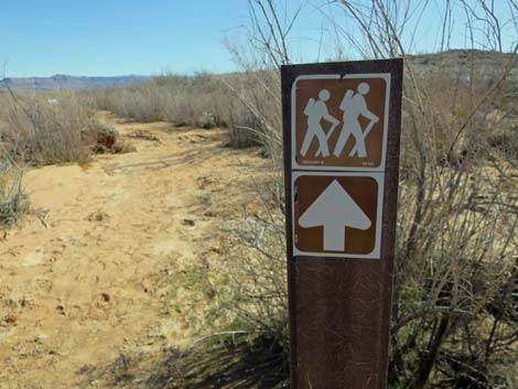 Sign: trail direction (view SE) |
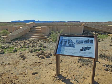
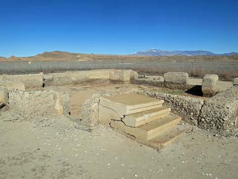
From the Mining Sign (Sign-11), another foundation lies to the north. This was the Nutter Store. Looking at the remaining walls, my guess is that we are seeing the basement. Not yet uncovered from the saltcedar, the Nutter-Hay storage building lies to the north of Nutter's Store, the Baver home and blacksmith shop lies just to the east, and the RO Gibson home lies to the southeast. Returning to the Mining Sign (Sign-11), a directional trail sign indicates that hikers should take a right turn to head southeast towards the next ruins. Alternatively, hikers can continue a few yards east to the street corner and turn right (south) onto a side street. The next ruin is the schoolhouse, as explained by another information sign (Sign-12). Education was important to the residents, evidenced by the sheer size of the two-story building that included four classrooms, an auditorium, and a dance floor where plays were staged. |
 Sign: information about farming here (view SE) |
From the schoolhouse, the trail, as marked on the "you-are-here maps," runs from the back (southwest) corner of the school building to the southwest through saltcedar thickets towards another set of ruins. However, it seems more reasonable to walk south on the road in front of the schoolhouse to the next street corner and turn right (link to map) onto the next street. Walking south on the road, hikers pass the MA Bunker home, on the right, then arrive at the street corner (Wpt. 05). Down the street to the south, a number of residences remain to be uncovered from the saltcedar thicket, including homes of Vern Howell, Albert Stresser, Frank Getzel, Jim Seller, Joe Pearson, Lyman Armfield, and the Foxley-Chadburn home. Turning right at the street corner (Wpt. 05) to head west, the trail begins returning to the trailhead, as this is the farthest point on the loop trail. Just past the corner, the foundation of the Luke Whitney house lies just off the road. It seems that the walls here were more polished cobble stones than concrete, and little remains. |
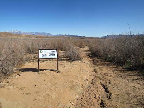
 Sign-02: information about farming here (view SE) |
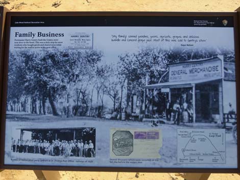
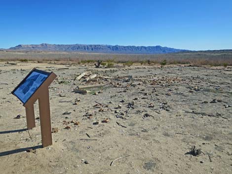
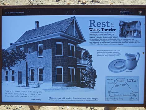
Continuing west on the road, a partially cleared side street runs north back to the Ice Cream Parlor, the top of which can be seen in the distance. On the left, the next ruin is visible. This long, narrow building was the post office. The next foundations and information sign can be seen a short distance farther west. The information sign, Sign-13, provides insight into one of the Gentry family businesses (here the general store) and also has a photo of the post office. As can be seen from the foundation, the store was a big building. Continuing west, ruins adjacent to the Gentry store are marked with another information sign (Sign-14), which provides information about another Gentry family business: the 14-room Gentry Hotel. |
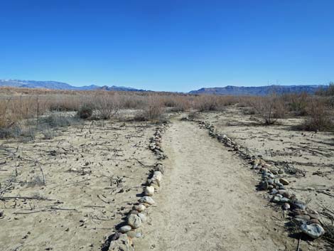 Initially the trail is lined with rocks (view SE) |
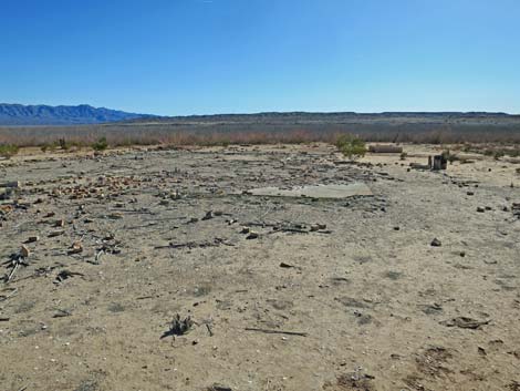
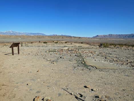
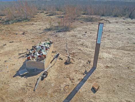
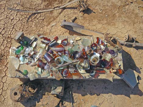
Stumps between the road and the information sign once were graceful trees that welcomed weary travelers to the hotel. The hotel was a two-story brick building. during demolition of the town, most of the bricks were salvaged and carted away, but enough remain to give the idea of former glory. There is a cistern out back, plus a collection of broken glass set on a concrete slab. While nice to see, visitors should refrain from making collection piles because doing so removes the item from the historical context, reducing the value to archaeologists. From the Gentry Hotel, ruins can be seen to the north across the road. This large house, with two sets of concrete stairs, was the Samuel Gentry home. As seen in other foundations, locally collected river cobbles were used in the concrete, and the foundation here is crumbling away. Back on the road continuing west, a smaller cleared area on the right reveals a curious concrete slab. It must have been laid for something specific, but who knows what. |
 But they ran out of rocks on the mudflats (note sinkhole; view SE) |
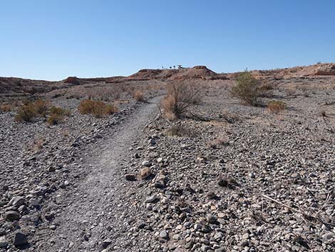
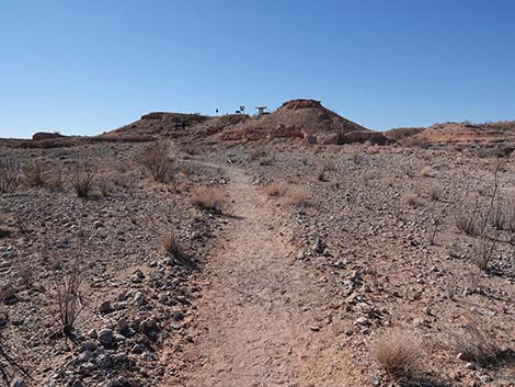
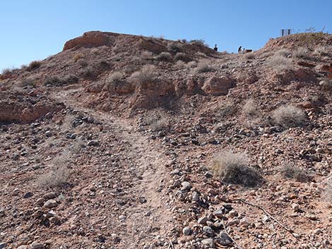
A bit farther up the road, a small foundation is visible on the left. It seems small, but it must have been part of a house because there is another cistern out back. A bit farther up the road, the last of the exposed foundations is visible on the right. This large foundation, with a canal passing by, was the Ed Syphus house. It is interesting to note the cut stones used in the foundation and the rather large cistern. From there, the street disappears into the thickets to the west, but the trail bends (Wpt. 06) northwest to head back towards the trailhead. The trail passes the Fenton Whitney home, the three signs, several more signs, and the Whitmore home to arrive at the toe of the ridge (Wpt. 02). From there, it is a short climb back to the trailhead (Wpt. 01). |
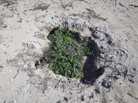 Sinkhole? What's down there? |
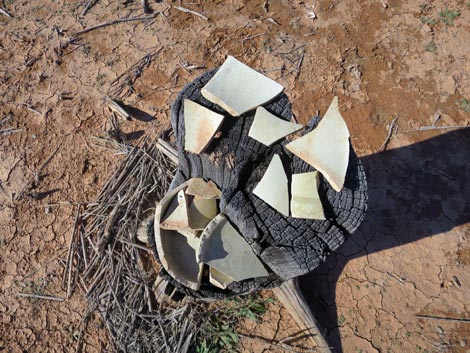
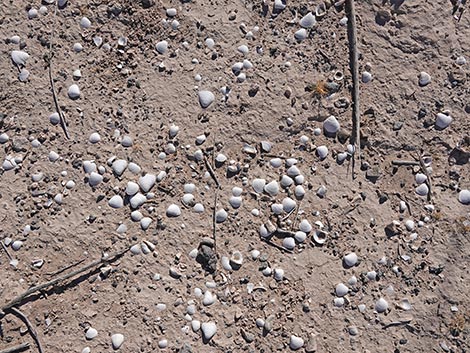 Asian Clam shells scattered across the lakebed |
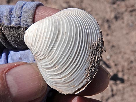 Asian Clam shell: side view |
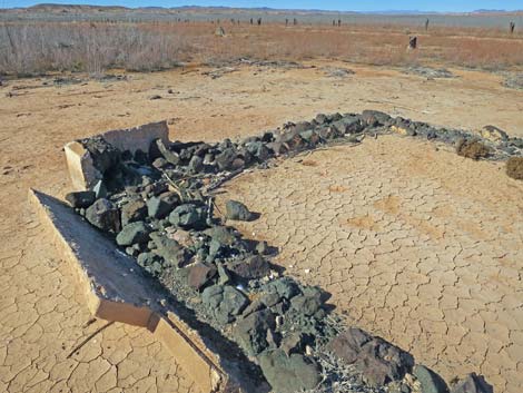
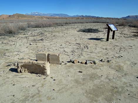 Concrete blocks that once lined an irrigation ditch (view SE) |
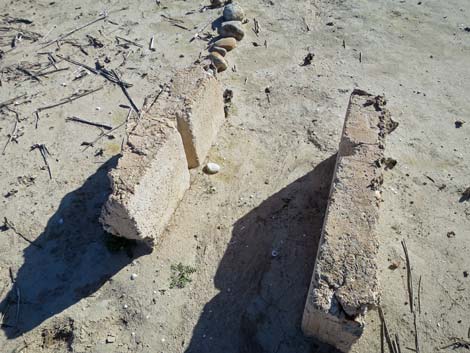 Concrete blocks that once lined an irrigation ditch (view S) |
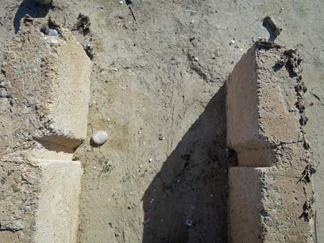 Boards dropped into the groves controlled water flow (down) |
 Information sign near concrete blocks (view SE) |
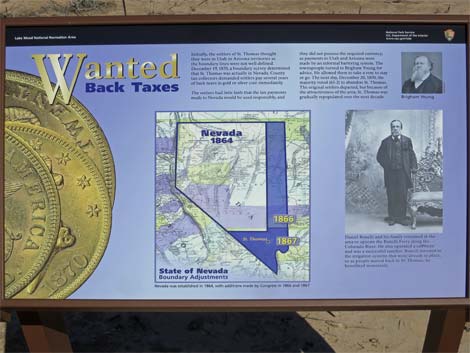 Sign-03: changes in state boundaries affected original residents |
 Another protect our shared history trail sign (view SE) |
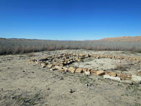
 Approaching the first ruin (view SE) |
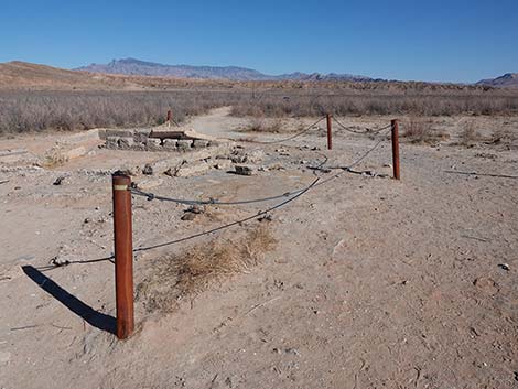 First ruin: Roxton Whitmore home (view E) |
 First ruin: Roxton Whitmore home (view NE) |
 First ruin: Roxton Whitmore home (view N) |
 Information sign: US government buys out residents (view SE) |
 Sign-04: US government buys out residents (view SE) |
 Hiker entering the main townsite area; info signs ahead (view SE) |
 Entering the main townsite area; three info signs ahead (view SE) |
 Info sign on right: bringing the railroad to St. Thomas (view W) |
 Sign-07: bringing the railroad to St. Thomas (view W) |
 Hiker at the two info signs (view SE) |
 Two info signs: water high and low (view E) |
 Sign-05: rising waters (note map inset; view E) |
 Sign-06: falling waters (view E) |
 View over signs into the main townsite area (view E) |
 Faint trail continues past the two info signs (view SE) |
 Hiker approaching old home buried in mud (view SE) |
 Ruin: Fenton Whitney Home (view SE) |
 Fenton Whitney Home partially buried by mud (view S) |
 Info sign at partially buried home (view W) |
 Sign-08: home, sweet home (view W) |
 Info sign close-up: real people with their dogs really lived here |
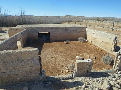 Fenton Whitney Home (view W) |
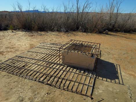 Fenton Whitney cistern behind the home (view W) |
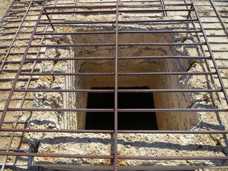 Fenton Whitney cistern (view down) |
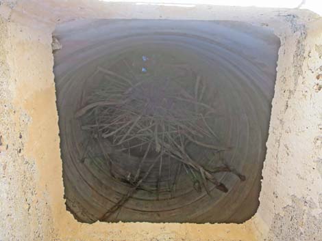 Fenton Whitney cistern (view down inside) |
 Trail returns towards Main Street (view NE) |
 Crossing main street (view NE; next ruin in the distance) |
 Hiker approaching the next ruin (view NE) |
 Frehner home (view NE from near Main Street) |
 Frehner home concrete foundation (view N) |
 Frehner home concrete foundation (view NE) |
 Trail departing the Frehner home (view E) |
 Side street (view N towards SE Whitney home) |
 Old fenceline on approach next ruin (view NE from Main Street) |
 Hiker approaching info sign (view E) |
 Info sign: water for drinking and irrigation (view NE) |
 Sign-09: water for drinking and irrigation |
 Frank Bonelli cistern (behind info sign; view N) |
 Inside Frank Bonelli cistern (view down inside) |
 Back on Main Street (view E) |
 On the right, RE Bunker home (view S) |
 RE Bunker home; construction details (view S) |
 RE Bunker home (view N) |
 RE Bunker home; sandstone floor (view down) |
 Hiker continuing on trail down Main Street (view E) |
 Hiker continuing on trail down Main Street (view E) |
 Hiker approaching St. Thomas Garage, on the left (view NE) |
 St. Thomas Garage (view N) |
 St. Thomas Garage (view N) |
 Hiker on Main Street, passing spur trail to the right (view E) |
 Spur Trail leads to Moses Gibson home (view S) |
 Approaching ruins of Moses Gibson house on the right (view SE) |
 Moses Gibson house (view SE) |
 Moses Gibson house; details of construction (view NW) |
 Moses Gibson house (view E) |
 Moses Gibson cistern (view NE) |
 Moses Gibson house; stairs on south side (view N) |
 Moses Gibson house; possible canal (view NW) |
 Moses Gibson house; possible canal (view NW) |
 Hiker at JF Perkins ruin on the right (view SE) |
 JF Perkins ruins and side road (view S) |
 More ruins on the right (view SE) |
 Hiker continuing on Main Street (view E) |
 Approaching Haninnig Grocery and Ice Cream Parlor (view NE) |
 Approaching Haninnig Grocery and Ice Cream Parlor (view NE) |
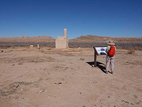 Info sign: Making a living (view N) |
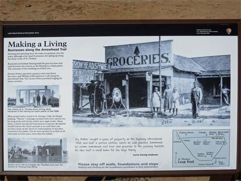 Sign-10: Making a living selling ice cream and groceries (view N) |
 Haninnig Grocery and Ice Cream Parlor foundation (view NW) |
 Haninnig Grocery and Ice Cream Parlor (view NW) |
 Haninnig Grocery and Ice Cream Parlor (view NW) |
 Haninnig Grocery and Ice Cream Parlor (view E) |
 Hiker continuing on Main Street (view E) |
 Hiker on Main Street approaching Nutter Store ruins (view E) |
 Nutter Store ruins on the left before the sign (view NE) |
 Approaching another info sign (view E) |
 Hiker at sign, which marks turn in the trail (view E) |
 Hiker at sign; Nutter Store ruins in the background (view E) |
 Nutter Store ruins (view NE) |
 Trail and info signs (view E) |
 Sign-11: Mining in the mountains (view E) |
 Trail and info signs; trail turns south here (view S) |
 Hiker approaching the school house (view S) |
 Hiker at school house (view S) |
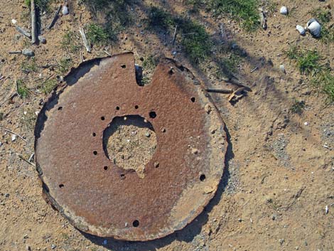 Rusted metal debris and Asian Clam shells (view down) |
 School house ruins (view S) |
 School house ruins (view S) |
 Info sign: St. Thomas school (view W) |
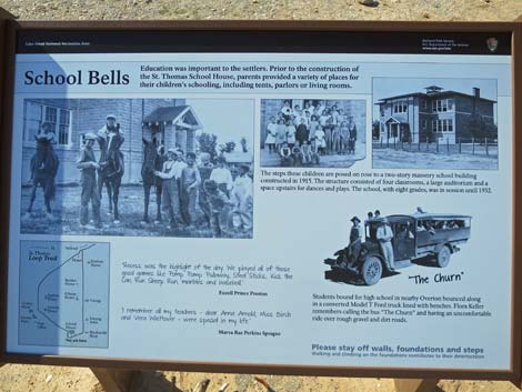 Sign-12: St. Thomas school (view W) |
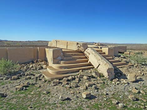 School house ruins (view NW) |
 School house ruins (view NW) |
 School house ruins (view N) |
 School house ruins (view NW from road) |
 Hiker departing the school house ruins (view SE) |
 Hiker on trail (view S) |
 Trail continues south, ruins of MA Bunker home on the right (view SW) |
 Ruins of MA Bunker home (view SW) |
 Trail follows road south to a corner (view S) |
 Trail follows the old streets to the right (view SW) |
 Around corner, trail starts back west (view W) |
 MA Bunker home back on the right (view N) |
 Luke Whitney ruin on the left (view S) |
 Treasure pile near Luke Whitney house (interesting, but don't do this) |
 Side road to the right (view N) |
 Trail continues on old road (view W) |
 Approaching ruins of Gentry Store (view W) |
 When approaching Gentry Store, ruins of post office (view SW) |
 Ruins of the post office (view S) |
 Approaching next ruin, on the left (view SW) |
 Hikers at info sign (view SW) |
 Info sign: family business (view SW) |
 Sign-13: family business (view SW) |
 Ruins of Gentry Store, a family business (view SW) |
 Gentry Store (view S) |
 Gentry Store (view SE) |
 Gentry Store (view E) |
 Gentry Store (view SE) |
 Continuing on the old street (view W) |
 Approaching the next ruin (view SW) |
 These trees probably grew along a property line (view SW) |
 Hiker at info sign (view SW) |
 Info sign and ruin on the left (view S from road) |
 Info sign: Rest Weary Traveler (view SE) |
 Sign-14: Rest Weary Traveler (view S) |
 Ruin: Gentry Hotel (view S) |
 Ruin: Gentry Hotel (view E) |
 Ruin: Gentry Hotel (view SE) |
 Cistern and watering trough (view S) |
 Ruin: Gentry Hotel (view S) |
 Ruin: Gentry Hotel (view W) |
 Ruin: Gentry Hotel (down) |
 Ruin: Gentry Hotel bricks (view S) |
 Ruin: Gentry Hotel (view N back towards the old street) |
 Continuing on the old street (view NW) |
 Approaching the next ruin (view N from roadway) |
 Samuel Gentry house (view N) |
 Samuel Gentry house (view NE) |
 Samuel Gentry house (view NE) |
 Unidentified ruin (view N from roadway) |
 Faint track to a ruin on the left (view S) from roadway) |
 Unidentified ruin (view S) |
 Continuing on the old street past concrete blocks (view NW) |
 Hiker continuing on the old street (view NW) |
 Faint trail departs old street (view NW) |
 Faint trail leads towards next ruin (view NW) |
 Approaching Ed Syphus house; passing old tree line (view N) |
 Canal beside Ed Syphus house (view NE) |
 Ed Syphus house (view N) |
 Ed Syphus house (view N) |
 Ed Syphus house (view NE) |
 Ed Syphus house (view NE) |
 Ed Syphus cistern (view NE) |
 Looking back at St. Thomas (view E) |
 Looking back at St. Thomas (view NE) |
 Trail departing the townsite (view W) |
 Trail departing the townsite, trail bends right (view NW) |
 Vehicles are visible at trailhead (view NW; extreme zoom) |
 Trail departing the townsite (view N) |
 Hiker on trail returning towards Main Street (view N) |
 Returning towards the first ruin in the main townsite (view N) |
 Arriving back at the first ruin on Main Street (view N) |
 First ruin on Main Street (view NE) |
 Returning towards the trio of information signs (view N) |
 Last view down Main Street (view E) |
 Returning past the cluster of three signs (view N) |
 Trail departing the townsite (view NW) |
 Trail departing the townsite (view NW) |
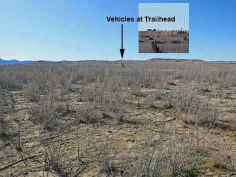 Vehicles at trailhead parking are visible in the distance (view NW) |
 Returning past info sign (view NW) |
 Returning past first ruin (view NW) |
 Returning past info sign and cement blocks (view NW) |
 Off trail -- approaching cistern (view N) |
 Off trail -- cistern (view N) |
 Off trail -- cistern (view NW) |
 Off trail -- cistern (view SE) |
 Returning past info sign (view NW) |
 Last trail sign before starting back up the ridge (view W) |
 Trail climbs a brief, steep section above lakebed level (view W) |
 The trail quickly levels out (view W) |
 Returning back up the ridge (view W) |
 On the ridge, nearing the trailhead (view W) |
 Trail switchbacks up the steep bluff (view NW) |
 Last climb to the top of the bluff (view NW) |
 Returning to the trailhead (view W) |
 Returning to the parking lot (view W) |
Table 1. Hiking Coordinates and Distances based on GPS Data (NAD27; UTM Zone 11S). Download Hiking GPS Waypoints (gpx) file
| Wpt. | Location | UTM Easting | UTM Northing | Elevation (ft) | Point-to-Point Distance (mi) | Cumulative Distance (mi) |
|---|---|---|---|---|---|---|
| 01 | St Thomas Trailhead | 734492 | 4038969 | 1,248 | 0.00 | 0.00 |
| 02 | Toe of the Ridge | 734703 | 4039132 | 1,164 | 0.19 | 0.19 |
| 03 | Main Street West | 735246 | 4038850 | 1,166 | 0.42 | 0.61 |
| 04 | Main Street East | 735762 | 4038878 | 1,149 | 0.32 | 0.93 |
| 05 | Southeast Corner | 735822 | 4038651 | 1,146 | 0.16 | 1.09 |
| 06 | Southwest Corner | 735495 | 4038629 | 1,148 | 0.21 | 1.30 |
| 03 | Main Street West | 735246 | 4038850 | 1,166 | 0.21 | 1.51 |
| 02 | Toe of the Ridge | 734703 | 4039132 | 1,164 | 0.42 | 1.93 |
| 01 | St Thomas Trailhead | 734492 | 4038969 | 1,248 | 0.19 | 2.12 |
Happy Hiking! All distances, elevations, and other facts are approximate.
![]() ; Last updated 250215
; Last updated 250215
| Hiking Around Lake Mead | Hiking Around Las Vegas | Glossary | Copyright, Conditions, Disclaimer | Home |