Hiking Around Las Vegas, Desert National Wildlife Refuge

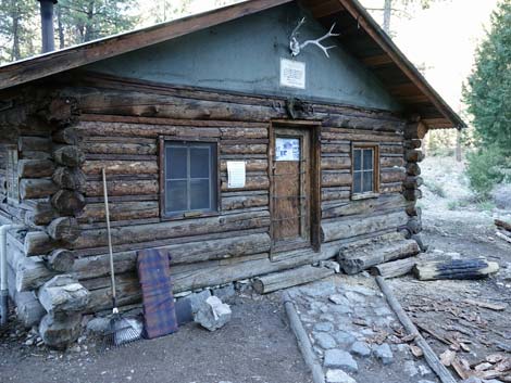 Hidden Forest Cabin (view NE) |
Overview There are several routes up Hayford Peak (9,912 ft). The strenuous route described here runs from the trailhead to Hidden Forest Cabin, climbs onto the ridge northwest of the cabin, and follows that ridge to the summit. This 15-mile round-trip route makes for a very long day trip or a nice overnight backpack with a night or two spent at the Hidden Forest cabin. Water should be available at the cabin. I've been told that some hikers prefer the route described here as the descent route rather than the accent route because there is no loss of hard-gained elevation by staying in the canyons. To each his own: I find that ridges generally provide easier off-trail travel. For general information on camping, regulations, other issues, and the natural history of the Wildlife Refuge, see the Desert National Wildlife Refuge -- Area Overview page. Link to map or elevation profile. |
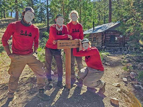 New trail sign near the cabin (view SE) |
Watch Out Other than the standard warnings about hiking in the desert, ...this is a relatively safe, off-trail route. There are no cliffs or other obstacles to climb, although there are some to get around. Always use extra care when hiking off-trail because the logistics of rescue are more difficult. Treat the spring water. Stay off ridges and mountain tops if thunderstorms threaten. Hiking in gravel or sandy washes is tiring, more tiring than might be expected; so don't underestimate the time it will take to hike up the canyon to the cabin. When dry, the trailhead should be accessible with a 2WD-HC vehicle, but inquire at the Corn Creek Visitor Center to be sure. While hiking, please respect the land and the other people out there, and try to Leave No Trace of your passage. Also, this is a long hike, so be sure to bring the 10 Essentials. This is a wildlife refuge, so pay extra attention to respecting the land. Please, don't bother the bighorn sheep. They have a hard enough time making a living in these desert lands; they don't need extra stress from people hanging around the spring. |
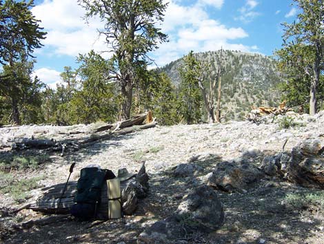
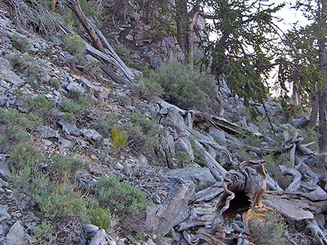
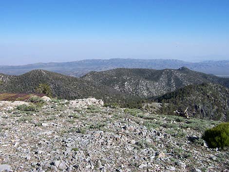
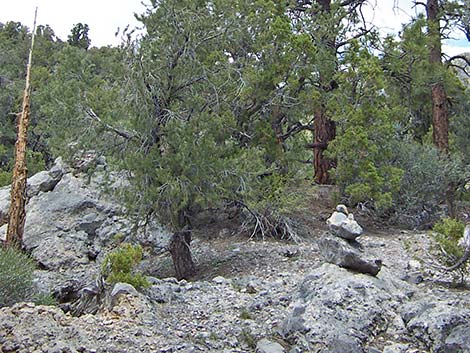 Cairn in the open, rocky area above Wiregrass Spring (view NW) |
Getting to the Trailhead This hike is located on the Desert National Wildlife Refuge, about 2 hours north of town. From town, drive out Corn Creek Road to Corn Creek Field Station. Continue east 100 yards to a T-intersection with a large directional sign. Turn left onto Alamo Road and drive north for 14.5 miles to Hidden Forest Road. Turn right onto Hidden Forest Road and drive east for 3.8 miles to a parking area at the end of the road. There are no turns, and the road ends against the first set of hills. Under normal conditions, these are good, well-graded roads. Park here; this is the trailhead. |
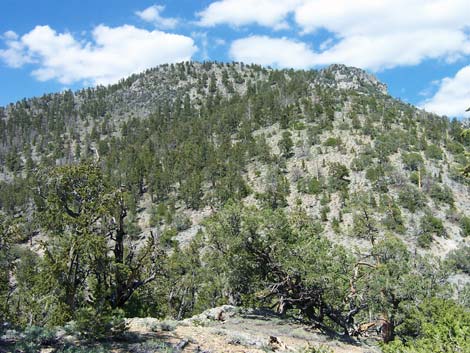
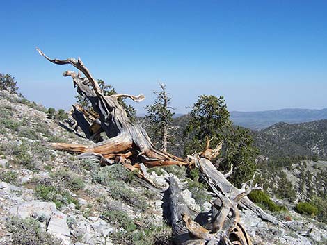
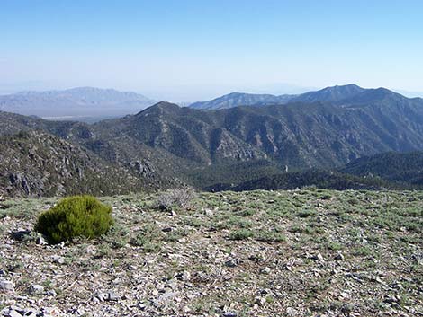
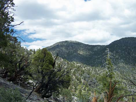 Hayford Peak (left; view NE from above Wiregrass Spring) |
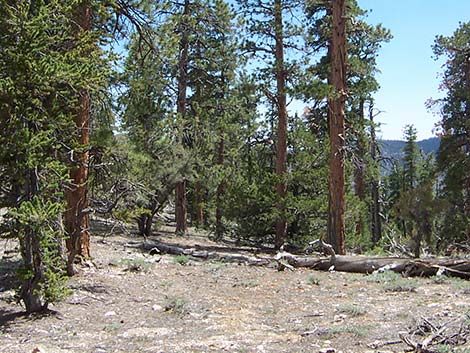
The Hike From the trailhead (Table 1, Waypoint 01), the old road continues past a gate and drops steeply into the wash. A sign at the trailhead says that Wiregrass Spring is 4 miles out, but the cabin is 5.7 miles out, and the spring is about 0.15 miles past the cabin. The route follows the old road through Deadman Canyon for 5.7 miles to the old cabin (Wpt. 05). For details on this part of the hike, see the description of the Hidden Forest Trail. The cabin is an interesting place to sit on the picnic tables, rest in the shade of tall ponderosa pines, listen to the birds and the wind, and contemplate the history and life during simpler times. The lay of the land around the cabin is a bit confusing, perhaps because the tall trees block views of the hillsides, an unfamiliar situation for us desert hikers. Also, it seems that the cabin should be in Deadman Canyon, but it is not -- it is in a side canyon. |
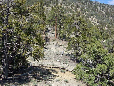
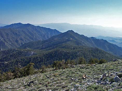
 Open, easy hiking on parts of the ridgeline (view N) |
Here, Deadman Canyon runs from desert flats in the west to the crest of the Sheep Range in the east, pretty much straight west-to-east for the entire way. The cabin is located in a side canyon that runs north from Deadman Canyon. The cabin is on the east edge of the side canyon, just above the confluence with Deadman Canyon, so standing in the door of the cabin and looking out, Deadman Canyon is off to the left (south), and the side canyon is to the right (north). Wiregrass Spring, which can be dry, is located up the side canyon, high above the streambed on the west side, so standing on the porch and looking out, the spring is up canyon to the right. These distinctions are important for hiking farther up the canyon and for finding the way back to the cabin. From the cabin (Wpt. 05), there are several routes up Hayford Peak. The route described here runs up towards Wiregrass Spring, climbs the ridge above (west of) the spring, and then follows ridges to the summit. |
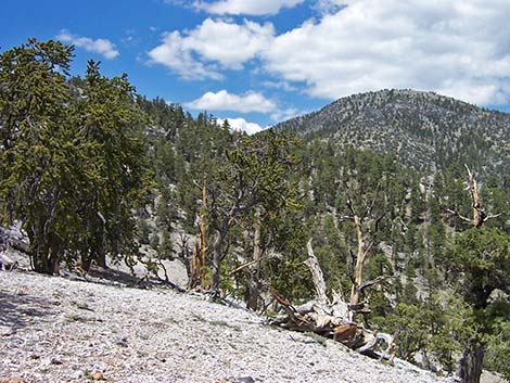 Hayford Peak in the distance (view NE) |
From the cabin (Wpt. 05), the route runs north, up the side canyon towards Wiregrass Spring, but in only a few yards, a trail sign indicates that the route turns right and angles up into the trees heading northeast following a built trail. At about 120 yards from the cabin, the trail switchbacks (Wpt. 06) to the left. The trail then climbs through a few more switchbacks before disappearing into the open scree slope above Wiregrass Spring. This new trail routes hikers away from the sensitive spring area. In the rocks and scree above Wiregrass Spring, the route continues climbing to the crest of the ridge (Wpt. 07; 0.4 miles out). The ridge is fairly open, and following it uphill (north) is easy, at least on the less-steep parts. There are scattered cairns along the ridge, but not really enough to call it a marked route. Some parts have more cairns, suggesting people might have started marking the route, got tired, and quit setting up cairns. Of course, it is a ridge, so there is no need for cairns. |
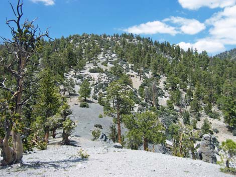 The route follows the open ridge (view N) |
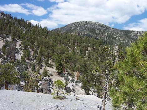
Initially, the ridge is forested with ponderosa pine and a few white fir, but up higher, these give way to limber pines and bristlecone pines. Ponderosa pines generally grow straight and tall, they have long (5 inch) needles that grow in bundles of two or three, and cones that hang down from the branches. White fir also grow tall and straight, but they have short, flat, unbundled needles that tend to grow laterally from the sides of the twigs, giving the entire branch a flat appearance. Firs also have cones that grow up from the top of the branches. At about 8,700 feet, hikers encounter the first bristlecone pines, which have short, thick needles that grow in bundles of five, the needles tend to grow thickly on the ends of the branches, and they grow all the way around the branch, giving the branch a bottle-brush appearance. On high-elevation ridges and steep side slopes, bristlecone pines grow twisted and gnarled, and some live for 2-3 thousand years. Before long, the peak and much of the remaining route comes into view. The route can be seen to stair-step up the ridge towards a high point southwest of the summit, then drop into a saddle, and finally climb the steep southwest ridge to the summit. The stair steps are fairly steep, but the vegetation is sparse, and the route is clear, plus the flat areas provide nice areas to rest in the shade of the trees. |
 Hayford Peak in the distance (view NE) |
As the route nears the highpoint on the ridge (Peak 9290), the saddle to the east come into view. Here, the route contours across side-slopes to avoid climbing onto the highest point, which actually is a bit off route, and drops into the saddle (Wpt. 08). This saddle marks the base of the steep southwest ridge of Hayford Peak. From the saddle (Wpt. 08), several possible routes run up the ridge, all of which are steep. The crest of the ridge is blocked by two rocky outcrops, and I tried two routes to bypass the cliffs. From this experience, staying on the north side of the ridge to bypass the cliffs is best. The south side of the ridge is covered with dense thickets of mountain mahogany, which can be worked through, but I would avoid the south side. When passing the cliffs, staying too close results in too much 3rd-class scrambling. From the saddle, the route climbs the ridgeline until drifting onto the north side of the ridgeline to bypass the cliffs. Above the cliffs, the route runs straight up the steep ridgeline to the summit (Wpt. 09). |
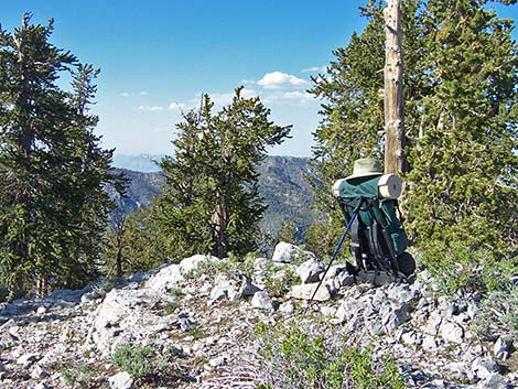
 A place to rest in the shade (view NE towards the peak) |
The summit is bald on the south side and forested with bristlecone pines on the north side (probably the result of a centuries-old fire). On the bald, the vegetation is Alpine, growing low and prostate to the ground. The plants are mostly sagebrush, with a few grasses and annual flowers. The wildlife refuge has a communications tower and support facilities on the summit, so it isn't exactly a wilderness, but hikers can sit on the south side, look south, and feel like they've climbed to the top of the earth. Without trees, the southern views are spectacular, extending west to Indian Springs and points into the distance, south along the spine of the Sheep Range to Las Vegas and mountains in the far distance, and east to the Arrow Range, Virgin Range, and points beyond. Looking through trees that partially block the view to the north, hikers can get tantalizing glimpses of interesting peaks and mountain ranges into the distance. When you are ready to depart, follow your footprints back to the cabin or take one of several other routes back. Perhaps the simplest route back to the cabin is to hike down to the saddle (Wpt. 08) at the base of the steep west face, then drop off the south side of the saddle into a canyon, and follow that canyon back to Deadman Canyon, which it hits a few minutes of walking upstream from the cabin. |
 The route follows the mostly open ridge (view N) |
 Dropping into saddle at the base of the SW ridge (view NE) |
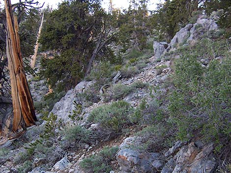 Steep hillside just north of rocky crags |
 Try not to get tangled up in the rocks and fallen trees (view S) |
 Approaching the summit, trees die out (view E) |
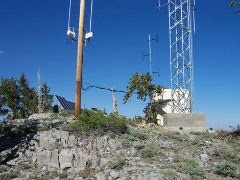 Communication facilities on the summit (view E) |
 The summit |
 Summit view (view SE) |
 Summit view (view S) |
 Summit view (view SSW) |
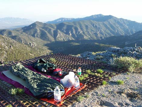 Room with a view (view S towards of Sheep Peak) |
 More to come ... |
Table 2. Hiking Coordinates Based on GPS Data (NAD27, UTM Zone 11S). Download Trail GPS Waypoints (*.gpx) file.
| Wpt. | Location | UTM Easting | UTM Northing | Elevation (ft) | Point-to-Point Distance (mi) | Cumulative Distance (mi) |
|---|---|---|---|---|---|---|
| 01 | Hidden Forest Trailhead | 653159 | 4054878 | 5,834 | . | 00.00 |
| 05 | Hidden Forest Cabin | 660325 | 4055282 | 7,944 | 5.20 | 05.20 |
| . | . | . | . | . | . | . |
| 05 | Hidden Forest Cabin | 660325 | 4055282 | 7,944 | 0.00 | 00.00 |
| 06 | First Switchback | 660368 | 4055382 | 7,927 | 0.07 | 00.07 |
| 07 | Crest of Ridge | 660141 | 4055754 | 8,146 | 0.49 | 00.42 |
| 08 | Saddle | 660362 | 4057741 | 9,143 | 2.30 | 01.88 |
| 09 | Hayford Peak | 660888 | 4058215 | 9,878 | 4.27 | 02.39 |
| 05 | Hidden Forest Cabin | 660325 | 4055282 | 7,944 | 7.17 | 04.78 |
| . | . | . | . | . | . | . |
| 05 | Hidden Forest Cabin | 660325 | 4055282 | 7,944 | . | 09.98 |
| 01 | Hidden Forest Trailhead | 653159 | 4054878 | 5,834 | . | 15.18 |
Happy Hiking! All distances, elevations, and other facts are approximate.
![]() ; Last updated 240717
; Last updated 240717
| Hiking Around DNWR | Hiking Around Las Vegas | Glossary | Copyright, Conditions, Disclaimer | Home |